
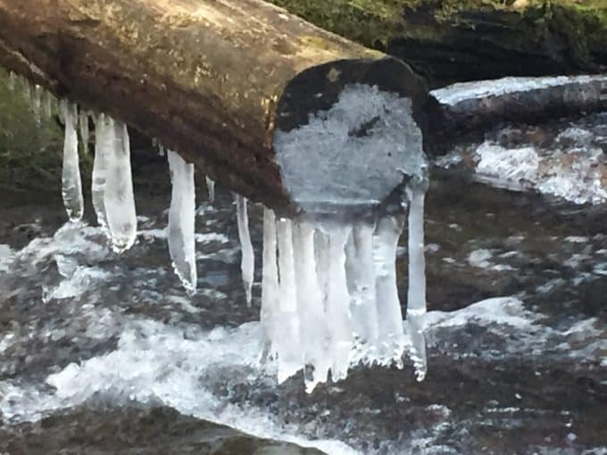
**My phone’s camera was acting up on this hike and these photos reflect that in the coloration. Things looked much less psychedelic than they appear in these images!
Search and rescue work isn’t always sunshine and roses. It can be chock full of anxiety and sadness, at least for someone who considers herself “a feeler” with a heck of a lot of empathy for the pain of others.
After an emotionally challenging mission for my team in recent days, I need the embrace of the Smokies to clear my head. A long day hike is in order and it’s just the medicine I need to return home with a genuine smile on my face.
I start my journey at Twentymile Ranger Station, a remote area of the park which allows much easier access to well-known Gregory Bald than the chaos of congestion of Cade’s Cove. The Bald isn’t my destination on this hike though. I am ready to knock off a new section of trail I have not yet traversed, as I slowly but ever so surely finish hiking every trail in the park.
Brrrr! It was in the 20’s when I started hiking.
The route is a convoluted figure 8-lollipop loop, combining 6 trails total! I have to refer to my map at each and every intersection to make sure I stay the course I set out to hike. I enjoy hikes with lots of trail intersections though. It makes each segment not feel so draining if they are challenging trails. This was a nice mixture of both ascent and descent, and by the day’s end I had gained 4,103 feet in elevation and lost 3,954 feet in 18.7 miles.
A mile and a half after setting out from the Twentymile trailhead, I turn off Wolf Ridge Trail onto Twentymile Loop Trail. The trail gradually climbs for nearly 3 miles, spitting me out at the Twentymile and Long Hungry Ridge Trails junction. I follow Twentymile east for another 2 miles which leads me to the Appalachian Trail, just north of Shuckstack’s rickety fire tower.
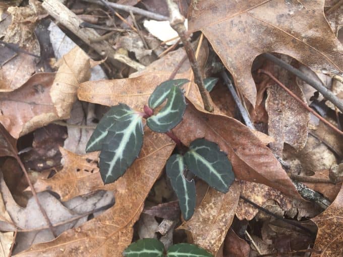
Striped Wintergreen, a.k.a. Pipsissewa
The fire tower is always a fun photo opportunity, perched high above Lake Fontana. But my plans are taking me in the direction of Maine today, albeit a couple thousand miles short of Katahdin.
It’s noon when I reach campsite 113, which sits below the trail. The campsite is vacant, but I discover the dimpled impressions of sit pads on the dusting of snow covering logs surrounding the fire pit. It’s damp and cold in this cove, and I’m thankful my plans won’t keep me here longer than my my meal. I heat my stove and enjoy a hot lunch, which is a welcome treat for my hands as much as my belly, as they hold my cooking pot.
I carry on, continuing on the Appalachian Trail which is covered in many spots by downed trees. I am curious to know if the deadfall will be removed by the time prime thru hiker season starts. Most are easy to navigate around, but they are plentiful and I wouldn’t want to be on this ridge during a wind storm!
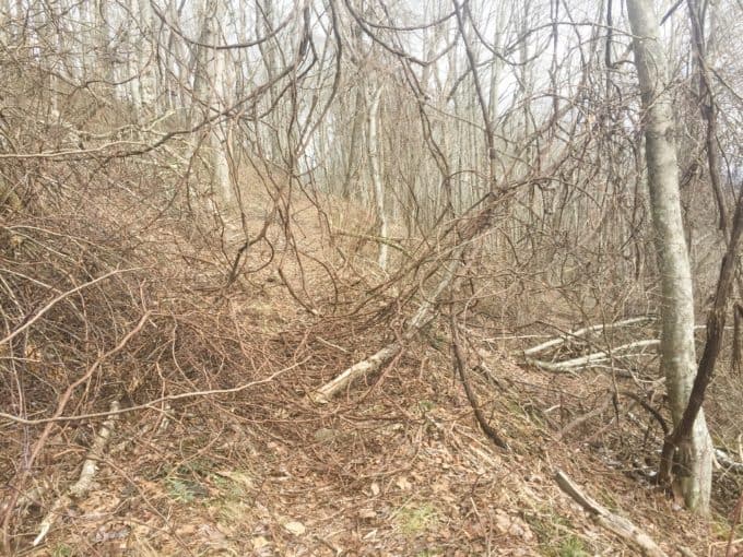
The obstacle course of the A.T.
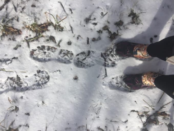
I am following tracks in the snow much larger than my own feet. Are there 2 or 3 sets? I can’t tell. It reminds me of this heartwarming story swirling around the internet. A good reminder that not all footprints in the backcountry snow have to lead to death.
I predict the footsteps I’m following will veer off north on the A.T. when I reach its junction with the Gregory Bald Trail at Doe Knob, but they continue with me.
A half mile or so up the Gregory Bald Trail, I see a blue jacket on the hill in the distance. Must be the owner of some of the tracks, I think. I make my way up to meet a kind backpacker named Jeff Cunningham. We are both members of a large Facebook group centered around trails in the Smokies, and I recognize his name from his posts!
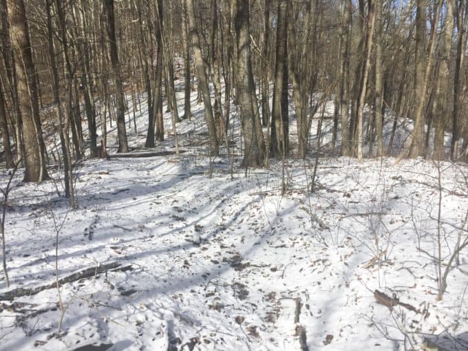
Yep, it’s still winter!
Jeff is here with his two brothers who are slightly ahead of him. They spent the night in 113 and are now headed to 13, just below Gregory Bald. It was really cold last night, he tells me. I offer him some of my foot or hand warmers for his cold night ahead, and he thanks me, but tells me he has some….he just wishes he had started using them sooner!
I hike on ahead, eventually meeting his two brothers who both grew up in Knoxville but now live in Orlando. They’re a fun group to talk with and I can tell they’re tight. Their bond reminds me of my own with my four siblings and they make me smile.
Jeff makes his way down the hill to meet up with his brothers and carry on, so I part ways with them and their footprints and head down Long Hungry Ridge Trail. I would love to extend my day a bit longer and incorporate Gregory Bald into my loop, but I know I’ll be pushing dark as it is, and I want to spend some time with my family tonight.
I head down Long Hungry Ridge and pull out my map, to confirm the distance I have left. Uh oh. How did I miss the “High Water Caution” warning on the map when I planned this route? Do I backtrack and head towards Gregory Bald, completing my loop with the Wolf Ridge Trail instead? Can I cross country over to it, if the crossing is unsafe? Nope, it’s a stupid move with no one knowing and it’s not even remotely close to where I’ll be at the creek. I vaguely remember the crossing from the previous summer, believing that I did indeed rock hop across it. But we’ve had so much rain. What will it be like now?
Turns out, it’s not at all dangerous when using caution, but it does require me to remove my shoes and socks and walk through it. My feet are positively numb after 30 seconds but at least I have dry socks and shoes to put back on!
It’s actually one of many crossings to come. The rest I’m able to navigate on rocks and dead trees, until the fifth and final one, when I step on a decaying log and it breaks with my weight. So much for my dry feet! At least I only have 3 more miles until my warm car carries me home.
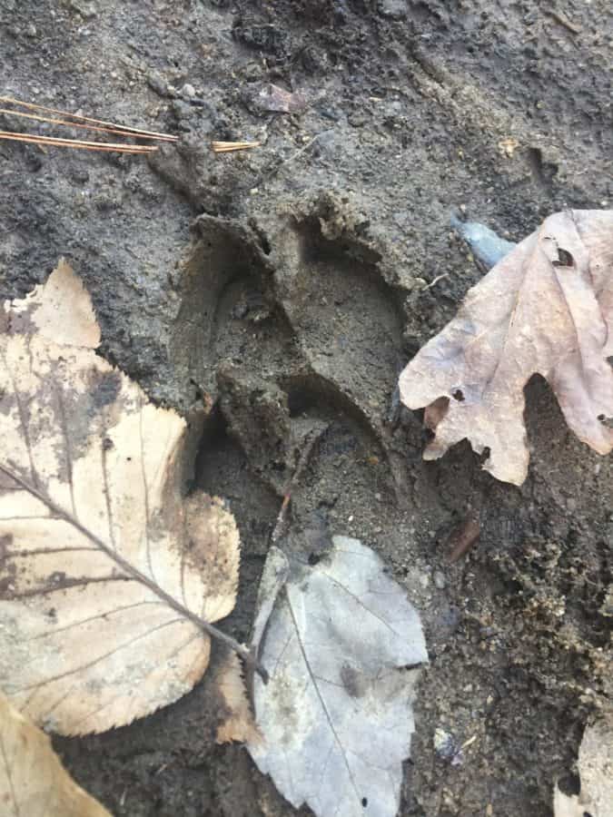
Deer tracks? At first I thought they might be wild boar, which I know are common in this area of the park, but they look too narrow.
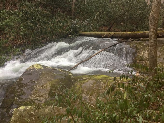
The last 3 miles tick by quickly, and I am thankful for the many well-constructed footbridges crossing Twentymile Creek which is raging! I take a quick side trip to Twentymile Cascades and they are impressive and extensive. The power of water never ceases to amaze me.
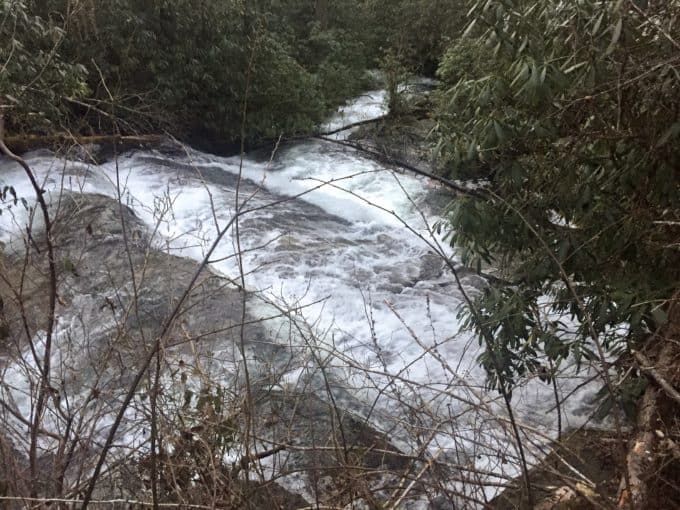
A small sampling of Twentymile Cascades.
I make it back to my car just as the light is fading enough to require a headlamp. But the only lights I need at this point are the headlights of my car, to bring me back home safely and with a much clearer head and heart, to my loving family.
It’s hard not to smile on a hike in the Smokies. 🙂
TRAIL REPORT CARD and GPX TRACK,
Mileage: 18.7 miles
Ascent: 4103 ft. Descent: 3954 ft.
Type of Hike: Lollipop-Figure 8 loop
Suitability for Kids: This hike is too long for most kids, unless they just love a long day in the Smokies as much as you do.
Dog Friendly: No. Dogs aren’t allowed on trails in Great Smoky Mountains National Park with the exception of the Gatlinburg Trail and the Oconaluftee Visitor Trail.
Permits: No permits are needed to hike the trails in Great Smoky Mountains National Park, but they are required for camping in the backcountry. Reservation information for backcountry website the park’s website.
National Geographic Trails Illustrated Map of Great Smoky Mountains National Park

I carry the 10 essentials in my pack at all times and you should too! If you’d like to know what gear I use and recommend, here’s my gear list. I also invite you to join my Facebook Group, where I not only post the best deals on quality gear that I can find, but I also provide education on backcountry safety topics via Facebook Live events. It’s a fabulous group of people and I like to think of it as one of the nicest Facebook groups out there. 🙂
[content-upgrade id=”3163″]