Spring in the Smokies–I just can’t get enough of it. I knew the weather was forecasted to be a bit sketchy the day of my hike, but I couldn’t resist the allure of spring wildflowers calling my name. My hike started from Sugarlands Visitor Center on the Tennessee side of the Park. I combined Huskey Gap, Sugarlands Mountain, Laurel Falls, and Cove Mountain Trails for a 19-mile loop. I then tacked on an out-and-back hike of the Gatlinburg Trail for my “Smokies 900” map.
My Hike
I wake up before the sun rises to start my drive to Sugarlands Visitor Center. It goes quickly as I listen to a great podcast on the benefits of trekking poles and how multiple studies have proven them beneficial for all sorts of things. I didn’t need convincing, but it’s good to hear the science backs up my beliefs about their benefits.
I arrive at Sugarlands Visitor Center and hike nearly 2 miles up Newfound Gap Road (Hwy. 441), which is closed due to the potential for snow, to the start of Huskey Gap Trail. Normally I’d be bummed that the road was closed since it would prevent me from driving through the Park to get to my trailhead. Today, however, I’m elated to have the road all to myself and avoid walking on the overgrown shoulder which is damp with tall grass.
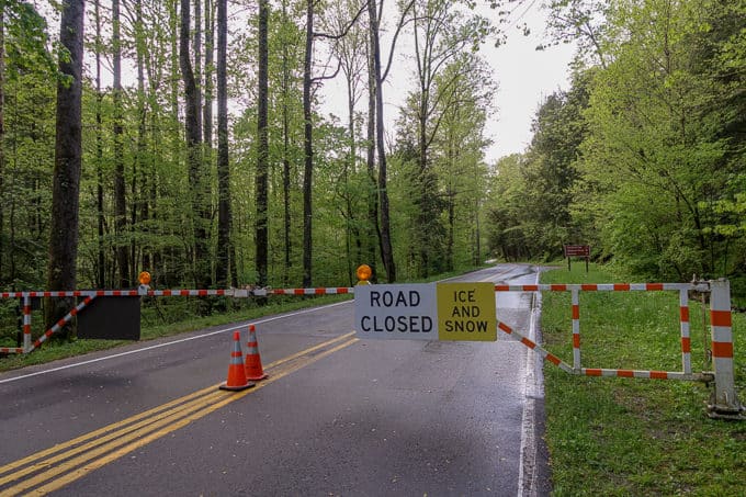
Sometimes road closures work in your favor!

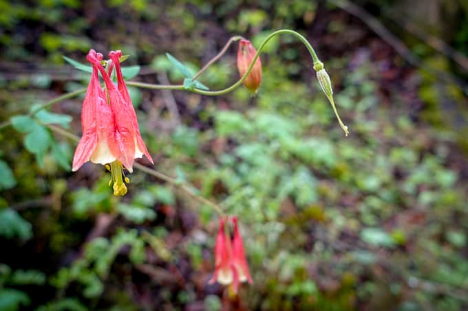
Columbine along the road
I reach Huskey Gap Trail and begin my ascent. The trail gifts me with peekaboo looks into the valley below along the way, and the elevation gain of this particular stretch suits me well as a warm up for the rest of the day.
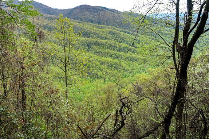
I love watching the mountains green upwards
Two miles later I’m at the top and heading down Sugarlands Mountain Trail. I love this trail. The tread is easy on the feet and for the most part, only has minor speed bump ascents that are easy to maintain my pace on as I hike. The name “Sugarlands” is an homage to early settlers of this area who tapped the sugar maple trees for sap.
-
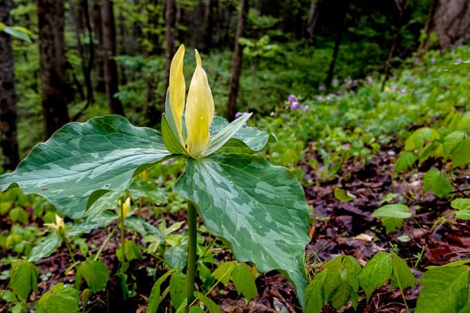
- Yellow Trillium
-
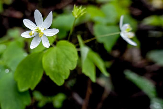
- Rue Anemone
-
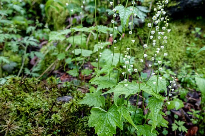
- Bishop’s Cap
-
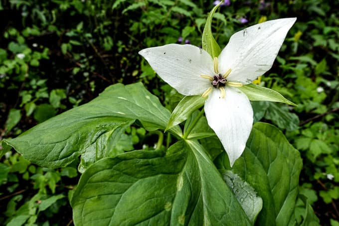
- White Trillium
-
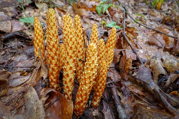
- Squawroot a.k.a. Bear Corn. Bears eat this in spring and it acts as laxative.
-
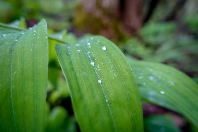
- Beautiful Smooth Solomon’s Seal. To tell the difference between it and False Solomon’s Seal, look under the leaves. For Solomon’s Seal to be real, it must have flowers under its keel (leaves).
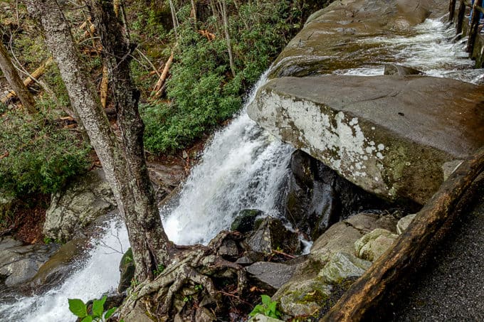
I reach Fighting Creek Gap and the Laurel Falls parking area, and my senses are shocked by the abrupt change in my environment. Cars fill the lot and the side of the road, likely taking 99% of the occupants to beautiful Laurel Falls.
My suspicion is quickly confirmed as soon as I start hiking up the paved 1.3 mile path to the falls. It reminds me of a little army of ants, all the people lined up, marching to their destination. It’s always an interesting experience, hiking on very popular trails with this many people. I am antsy to move at a faster pace, but it’s tough to navigate around this many people without feeling rude. So for the majority of the trail I hike along with them, conversing with a couple of nice families on the way.
Near the falls, I see someone scooping stream water with his hand and drinking it unfiltered. I see another young male scaling up the side of the falls on the wet, slippery rocks. I cringe at both sights, wishing people would make better choices in the backcountry to avoid illness and injury or death.
Preparedness Pointer: Always filter your water from backcountry water sources to avoid nasty “souvenirs” like Giardia or Cryptosporidium. Scaling the side of a waterfall is one of the riskiest things you can do on a hike and if you need more convincing of that, read this and learn more. Please resist the temptation because your life is worth more way more than the challenge of it.
Laurel Falls
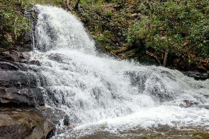
Laurel Falls
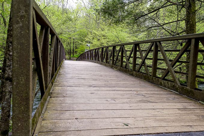
After crossing the bridge over the falls, I leave it and the droves of hikers behind, continuing my climb upwards. I hear the waters of Jay Bird, Red Bird, and Tanager Creeks below me (don’t you just love those names?!). When I round the corner and leave the sound of water behind me, I’m treated to actual birds, not just creeks named after them.
First, I hear a Barred Owl with its recognizable “Who cooks for you! Who cooks for you all!” hoot, somewhere beyond my sights on the hillside. Shortly after, I hear an Ovenbird nearby, its loudly escalating song which always makes me laugh. Such a big voice for a such a small bird!
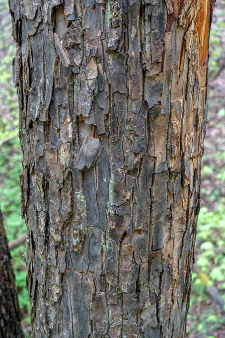
Carolina Silverbell bark has a distinct purplish hue to it and is “flaky”
To confirm your suspicion of Carolina Silverbell bark in spring, just look at the ground and you’ll probably find fallen “snow” flower petals.
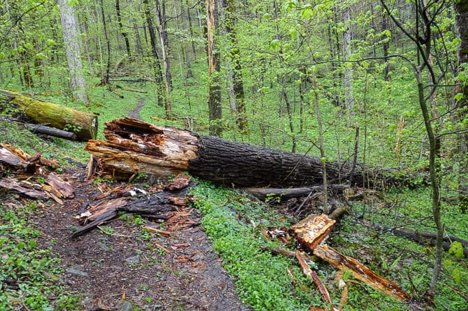
Such a huge tree amongst all the green!
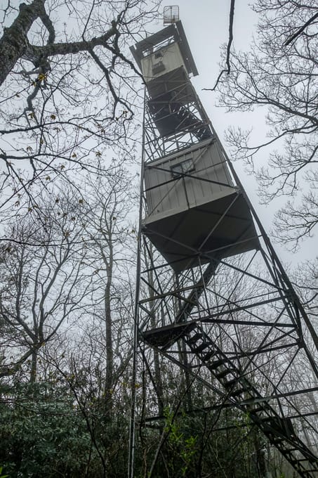
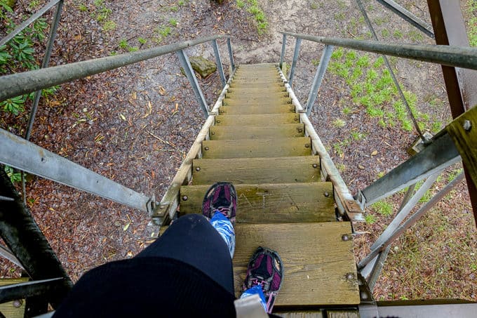
I come to the junction of Cove Mountain Trail but make a quick 0.1 detour to the left, to visit the fire tower turned air quality monitoring station. No one is allowed into the fire tower these days, but I can’t resist climbing the first flight of its steps anyway.
I move on down the trail, stopping for lunch on the ridge. Rain, snow, and sleet simultaneously join me as my lunch date as soon as I sit down! I’m thankful for both my extra layers that I packed as well as my rain gear, especially my Liteflex umbrella. Without it, I would likely have chosen to eat “on the go” instead of taking the time to sit down and enjoy my surroundings. It will always and forever remain my favorite piece of rain gear.
Preparedness Pointers: Hypothermia is a risk in every season in the Smokies, and people are often caught off guard in the “shoulder seasons” of spring and fall. Make sure you always carry your 10 essentials (and if you don’t know what those are, head here for a list of them) and I highly encourage you to learn more about one of the sneakiest dangers in the backcountry–hypothermia.
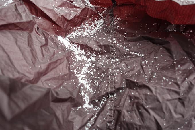
Sleet collecting on my rain wrap as I ate my lunch!
After my refuel pitstop, I hike on down the mountain, cruising more quickly than I normally would at the end of a long day hike, since the grade lends itself to a fast descent. Before I know it, I’m back at Sugarlands Visitor Center.
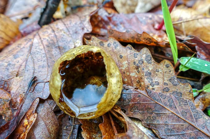
Such a cool insect gall, filled with rain water!
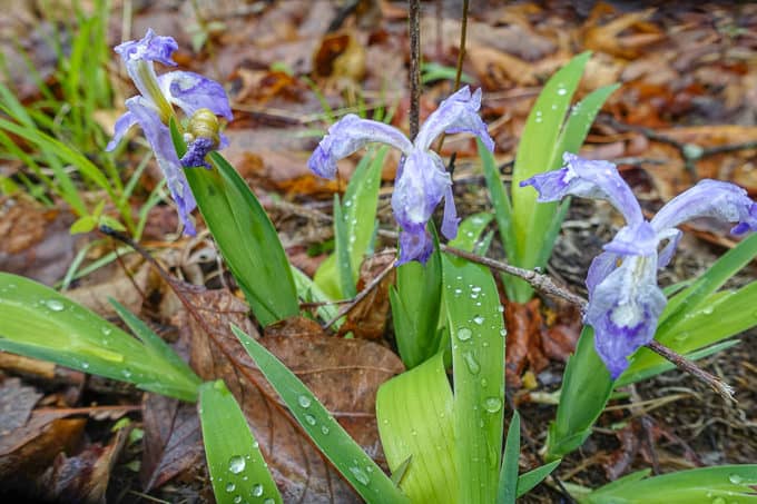
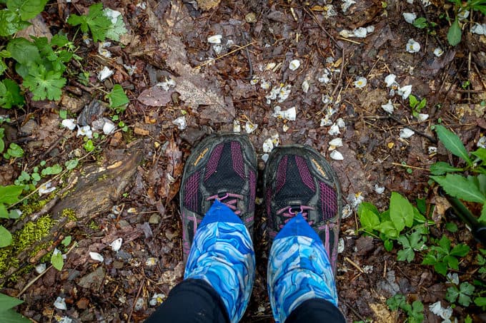
The Dwarf Crested Iris took a beating with the recent heavy rains
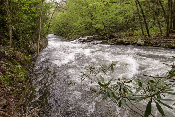
I finish early, so I decide to add on the Gatlinburg Trail since it’s one of the required trail to earn the honor of hiking all the trails in the Park. It adds another 4 miles onto my day, but the walking is easy along a wide, paved and gravel path, all the way into Gatlinburg. The water is raging in the West Prong of the Little Pigeon River, compliments of all the rain that fell over the last 24 hours.
I reach the end of my journey and head for home. Another delightful day in the woods!
TRAIL REPORT CARD and GPX TRACK
Mileage: 23.36 miles total, which includes the Gatlinburg Trail
Ascent: 3841 ft. Descent: 3967 ft.
Type of Hike: Loop
Potential Hazards: Road walking Hwy. 441 could potentially be hazardous if the road is open. While the shoulder is fairly wide in all spots, you’re still going to deal with distracted tourists who may not always stay on the road. 😉 There are no significant hazards while hiking the actual trails though. Water is fairly scarce once you pass Laurel Falls, until you get close to Sugarlands Visitor Center again.
Suitability for Kids: The mileage of this hike would eliminate this from most kids’ lists; however, if they are older and capable of tackling it, Laurel Falls and the fire tower will likely be the highlights for them (but I think there are better options for big loops in the Park that would appeal to kids more).
Dog Friendly: No. Dogs aren’t allowed on trails in Great Smoky Mountains National Park with the exception of the Gatlinburg Trail and the Oconaluftee Visitor Trail.
Permits: No permits are needed to hike the trails in Great Smoky Mountains National Park, but they are required for camping in the backcountry. Reservation information for backcountry website the park’s website.
National Geographic Trails Illustrated Map of Great Smoky Mountains National Park

I carry the 10 essentials in my pack at all times and you should too! If you’d like to know what gear I use and recommend, here’s my gear list. I also invite you to join my Facebook Group, where I not only post the best deals on quality gear that I can find, but I also provide education on backcountry safety topics via Facebook Live events. It’s a fabulous group of people and I like to think of it as one of the nicest Facebook groups out there. 🙂
My Gaia Track
If you are interested in using Gaia, you can get a 20-50% discount off a Gaia subscription (and I highly recommend it. I use it for both SAR and personal use).
[content-upgrade id=”3163″]