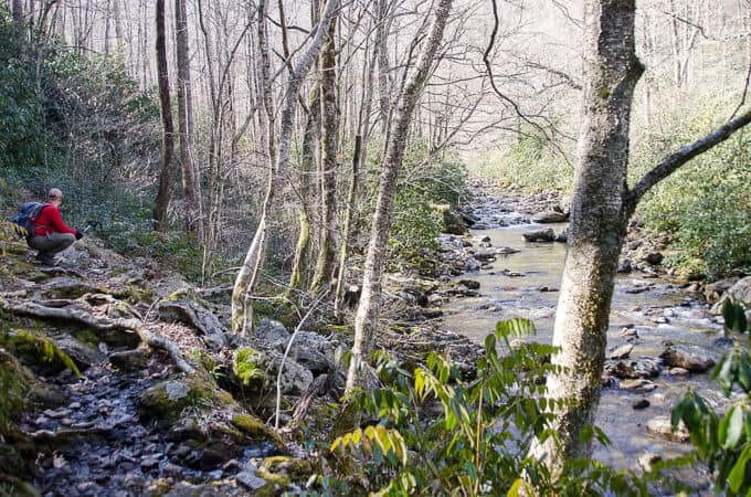
There are certain trails in western North Carolina that I find myself hiking repeatedly. It’s usually due to their spectacular scenery or their easy access, but rarely is it a combination of the two. The Big East Fork Trail in Pisgah National Forest is a trail that fits both of these criteria though, and I love it in every season.
Larry and I played hooky from work recently and hiked it while the kids were at school. Spring had already sprung via the calendar, but you wouldn’t have known it by the trail. Ice formations were a constant visual feast. Coupled with the melodic sounds of the Pigeon River and a relatively easy hike, it made for a fantastic date.
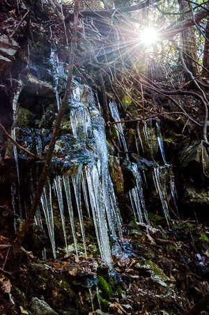
Big East Fork
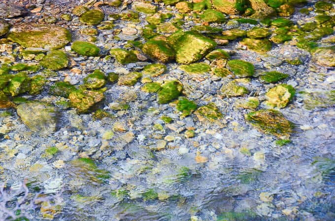
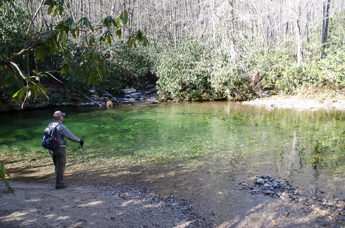
The water was crystal clear
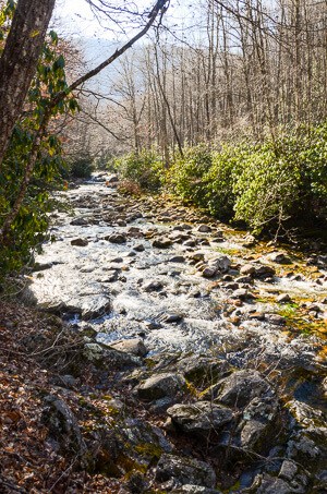
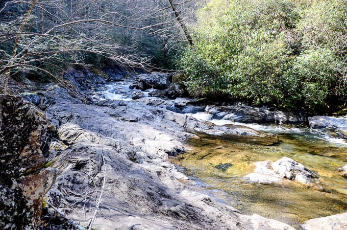
The trail meanders along the East Fork of the Pigeon River the entire way, the sunlight reflecting off the algae covered rocks in the river, giving them a verdant green glow, reminding me of Scotland. There are occasions when the trail meets the river’s edge itself, necessitating a short walk across the boulders on its banks. Careful foot placement is a necessity in these areas, as the rocks are often wet and sometimes slippery.
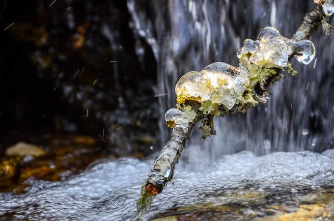
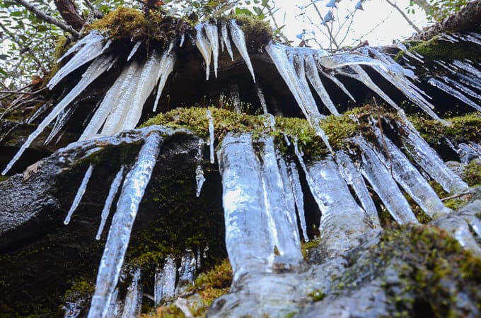
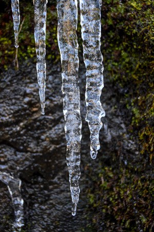
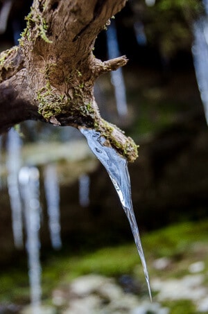
In winter, ice abounds in the shade, and I had a difficult time pulling myself away from studying and photographing icicles. The intricacies of an icicle, when I really stop and study it, never ceases to mesmerize me.
(click on any photo to be taken to a slideshow)
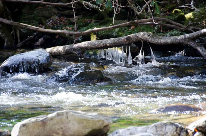
At close to the 1-mile mark, Shining Creek joins the Pigeon River and the confluence of the two is a spot worthy of a “pack off” break in summer months to enjoy the scenery, despite the short distance from the trailhead. Shortly after this spot, the trail crosses Bennett Branch. In winter, careful foot placement is necessary since it’s shaded with ice covering many of the rocks.
The confluence of Shining Rock Creek and Big East Fork
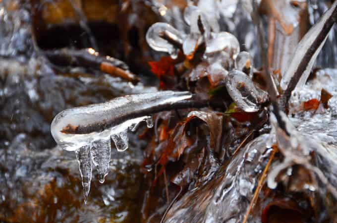
I loved the ice hanging off this limb
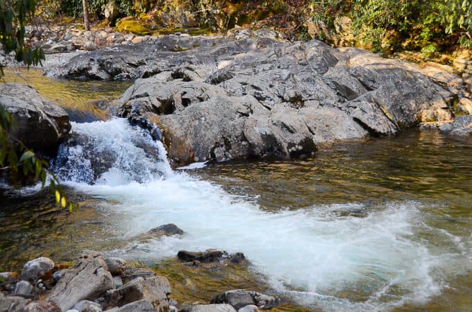
Beyond Bennett Branch, the trail gently climbs and the riverbank becomes significantly steeper beside you. The water below is more turbulent as the river narrows, forcing itself through narrow bedrock. How long has this mass of rock been here, I wonder, acknowledging that my mind really can’t even comprehend the answer to that question.
The trail eventually curves in a wide arc to the right, heading west around the base of Nobreeches Ridge (I just love the name of this ridge). The trail seemingly disappears briefly, but by following the boulders on the ege of the water, the trail becomes obvious again quickly.
The trail crosses along the boulders here.
At the 3.5 mile mark, a campsite is reached at the confluence of Greasy Prong and the East Fork. From here, Greasy Prong can be carefully crossed and the Greasy Prong Trail accessed. The Big East Fork Trail also changes names to Bridges Camp Gap Trail, since you have now entered Shining Rock Wilderness. Bridges Camp Gap Trail is to your left from the campsite and it climbs for another mile to the Blue Ridge Parkway. For our hike, however, this was our turnaround point for the day.

Josie especially loves that Big East Fork Trail is dog friendly. 🙂
Trail Report Card and GPX Track
Overall Grade: A+.
Mileage: Our total hike was 7.1 miles.
Ascent: 723 feet. Descent: 714 feet.
Type of Hike: Out and back.
An excellent 2-car shuttle hike leaves from Graveyard Fields, hitting the Mountains to Sea Trail (MTS) heading east. Bridges Camp Gap intersects the MTS Trail, which you’ll take, and then Bridges Camp Gap changes names to Big East Fork after a mile, leading you back to Hwy 276 to your other waiting car.
Suitability for Kids: I think this is a great hike for kids, even the younger ones as long as they are carefully supervised on the water’s edge. At the 1-mile mark where Shining Creek meets the Pigeon River, there is an excellent swimming hole for the warmer months.
Dog Friendly: Yes. Here’s where the veterinarian in me comes out and encourages you to read my post on best practices for hiking safely with dogs.
How to Get Here: Big East Fork Trailhead on Hwy 276. This hike does not depart from the big parking lot at Big East Fork but rather an auxillary parking area on 276, heading towards Brevard. It’s on the same side of the road as the main parking lot and should be easy to fine. It is obvious where the trail starts from this parking area.
Special Notes: Since this trail is in a designated wilderness area, there are no blazes to mark the way. Make sure to always carry the 10 essential systems on any hike (and know how to use them).
Resources for Hike:
National Geographic Pisgah Ranger District Topo Map

The Best Hikes of Pigsah National Forest by C. Franklin Goldsmith, and Shannon and James Hamrick

GPS Track of our hike
[content-upgrade id=”3614″]