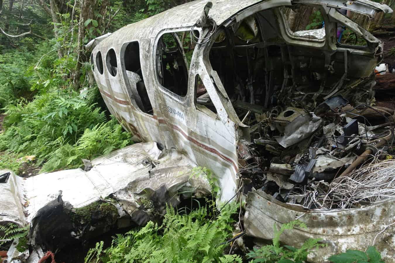
As my kids get older, I find myself struggling to come up with hikes that will interest them. I knew a short trek to airplane crash site and wreckage from the 1980s, just off the summit of Browning Knob, would probably impress them. As someone who comes from multiple generations of aviators (and who is strangely not crazy about flying in planes), hikes like this are not my thing and I’ve held off taking the kids to it. But alas, I knew my minions would not be as emotionally affected by the site and would love the experience. I was spot on with my projection.
I highly recommend this hike for older kids, or very well-behaved younger kids. I also recommend not telling your kids what you’ll come across on the hike. One of the best parts of the day was walking towards the wreckage through a makeshift path in the woods and hearing their reactions as they walked closer to it. It went something like this, “What the heck is that down there? Is that a bus? Wait a minute, that’s not a bus, it’s a freaking plane! Mom, did you know we were going to find this?!” I so wish I had captured it on video, but I didn’t start recording quickly enough, since I wasn’t quite sure how soon we’d come across it.
Speaking of video, I made one of the day’s hike, outlining the general path to get to the site and what to expect in regard to the terrain:
Here’s the general gist of how to get to the crash site:
- Hike the 0.5 mile path to Waterrock Knob, almost to the top.
- Just before you reach the last stretch of trail to the top, you should see a fairly obvious trail leading off to the left, marked with flagging tape.
- Take this trail. It will quickly descend and it’s not always easy to traverse. Careful foot placement and control of your kids is imperative. There are a couple of places where you’re hugging the side of the mountain and a fall down the hill could result in some injuries.
- Eventually you’ll crest Browning Knob and have a beautiful view on a clear day (you’ll even see the Waterrock Knob parking lot).
- On Browning Knob’s summit, look for a trail to the left (heading North). Take this short trail down a hillside and you will see the wreckage very quickly.
- Please be respectful of this site. Both men in the plane lost their lives in this crash, and it is a sobering to think of their final moments. Also, keep a close watch on your kids. There are plenty of places where they could get cut by jagged edges on the plane.
Part of the fun with this hike is the excitement of discovering the plane semi-unexpectedly. However, this is an easy area to get turned around in and potentially lost, since these are not official trails. Here’s my Gaia track if you’d like to use it as a reference. The hike is only about 2 miles, round trip.
If you’d like to know more about the cause of the accident, this incident report from the National Transportation and Safety Board gives some details.
As with any hike, make sure you always have the 10 essentials in your pack. Having what you need to survive at all times could truly save your life one day.
Happy Trails!
Nancy
P.S. If you’re new to hiking/backpacking and would like to learn more about safe practices (I’m a search and rescue member so this is a topic near and dear to my heart), I invite you to sign up for my free series of emails, outlining best practices on a hike, as recommended by search and rescue teams. I also have an associated Facebook Group where I share deals and sales on quality gear, in addition to outdoor education topics.
My Gaia Track for the Hike
[content-upgrade id=”3163″]