Quick Look at Chimney Tops Trail
- Distance: 3.5-mile out-and-back
- Elevation Gain: 1600 feet
- High Point: 4668 feet
- Difficulty: Strenuous
- Trail Surface: Dirt and stone with many steps
- Map: 7.5-min. Mt. LeConte, Clingmans Dome; 100 Favorite Trails of the Smokies and the Carolina Blue Ridge
- GPS: 35.63545N, -83.46976W
- Notes: Day-use only, good for older kids, no restrooms at trailhead, dogs not allowed, best hiked in spring, summer, fall or mild winter days
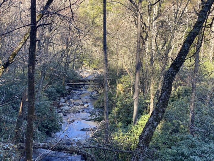
One of the park’s most popular trails, Chimney Tops rewards visitors with spectacular views and several bridged crossings of picturesque Road Prong Creek. For its short length, the trail boasts impressive elevation gain with hundreds of steps in the first mile and over 900 feet of gain in the last mile. It’s a quick way to work off the calories of a hearty breakfast in one of Gatlinburg’s pancake houses! The views are worth the effort, rewarding hikers with a commanding view of the chimney pinnacles and Mt. LeConte’s broad summit at the observation point near the trail’s terminus.
Getting There
From Sugarlands Visitor Center, drive 6.7 miles south on Newfound Gap Road (or 22 miles north from Oconaluftee Visitor Center). On the west side of the road, look for a large parking area between the lower tunnel and “the loop.”
On the Trail
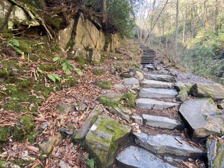
The trail begins in front of the parking area with a short downhill section on stone stairs. Don’t get used to descending though, because from here on you’ll steadily gain in elevation.
It’s not all bad though, as the noise of Newfound Gap Road is quickly replaced by the rolling water of Walker Camp Prong of Little Pigeon River, which you’ll cross on a 70-foot bridge spanning the water below. The bridge was reconstructed after being washed away by flooding rains on January 30, 2013. Take a moment to enjoy the beauty of the boulder-filled creek and imagine the depth the water would need to reach to crest this bridge.
Continuing on, you’ll start ascending several flights of stone steps—367 in total, each stone weighing an average of 300 pounds. Crews working for the Trails Forever Program in 2012 placed them into the slope to protect the popular path from erosion.
As you climb, look up and to the right to catch glimpses of the chimneys and surrounding ridgelines. Rhododendron and mountain laurel blooming alongside the trail in spring and summer. The mountainside also boasts a multitude of wildflowers, including trillium and hepatica in spring and bee balm, jewelweed, and Joe-Pye Weed in summer.
You’ll cross Road Prong, which later feeds into Walker Camp Prong, twice on bridges before reaching Beech Flats and the junction with Pole Road Creek Trail at 0.9 miles. You are now roughly halfway into the ascent.
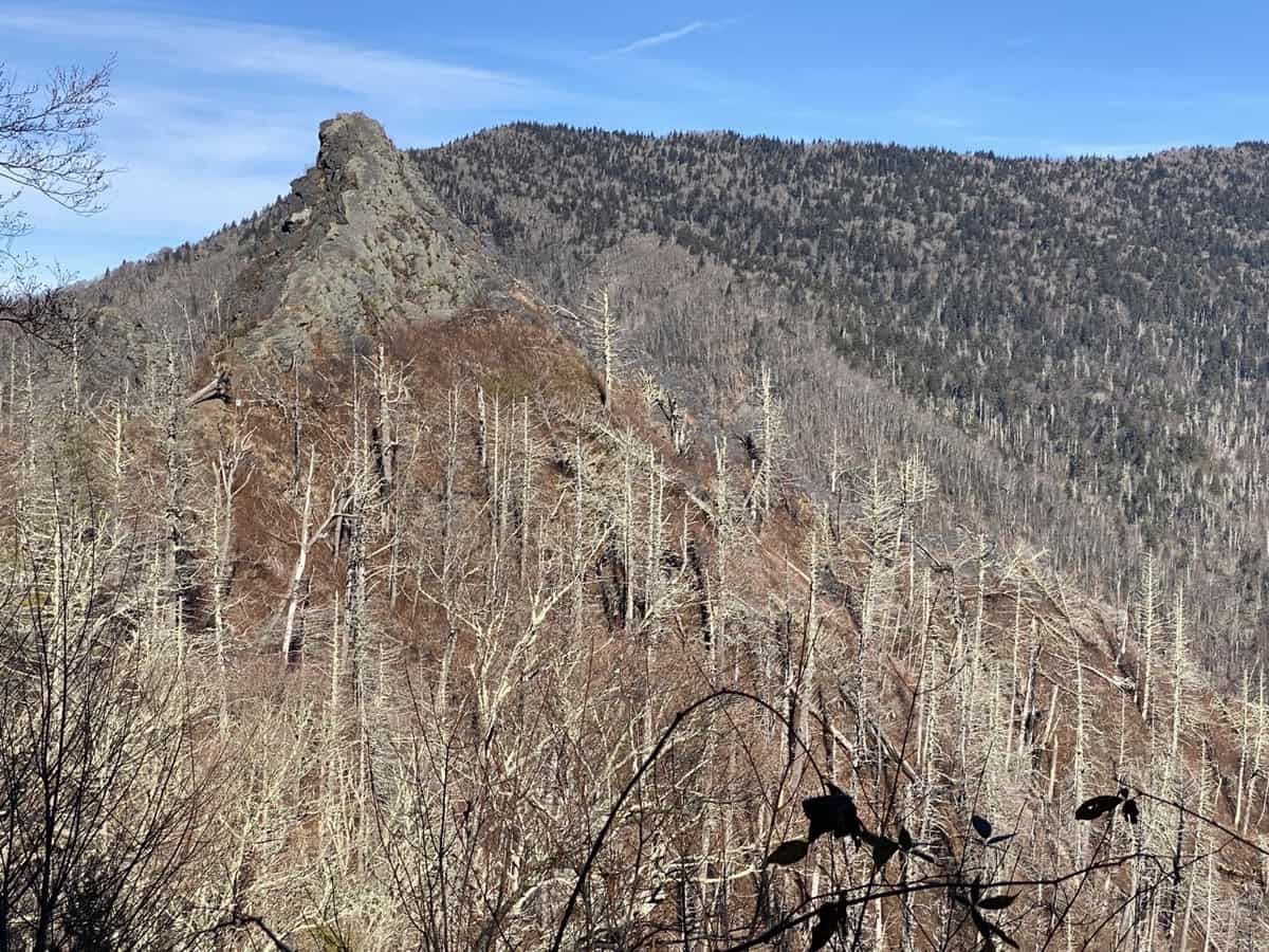
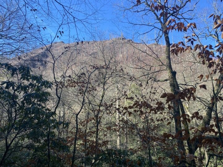
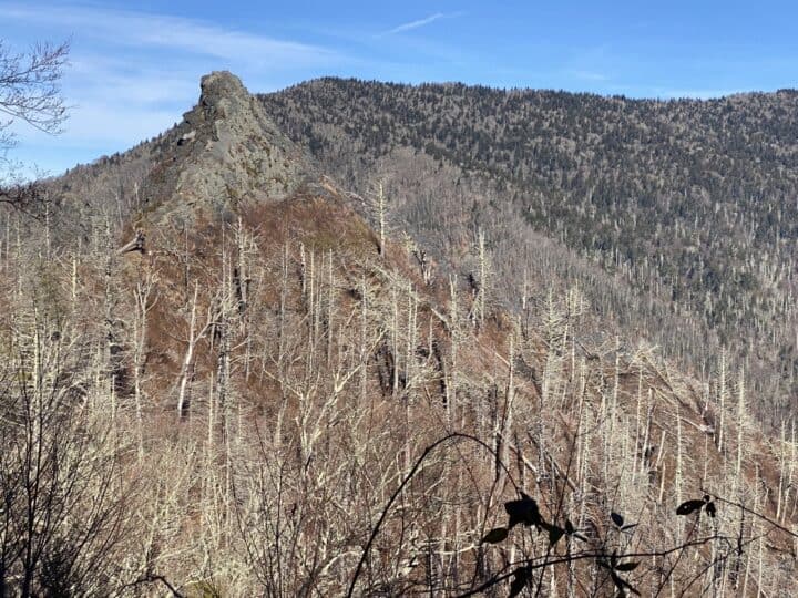
Continue to the right and begin climbing steeply through a creek valley in a westward direction before heading northwest in the final push to the observation point. Take your time and remember that all climbs eventually end. This one rewards you with a commanding view of Mt. LeConte’s elongated summit and the majestic pinnacles of the chimneys.
The trail continues on to the left for a short distance beyond the observation point, and you’ll get an even better view of the chimneys along this short stretch. In less than 0.1 mile, you’ll reach the obvious turnaround point at a gate crossing the entire trail. In 2016, during drought conditions, wildfires burned over 11,140 acres in the park. The fire started near the summit of the chimneys.
The area beyond the gate and the chimneys summit is closed to visitors indefinitely for safety reasons. In an October 3, 2017 press release, park officials stated that, “If in the future the ground is determined to be safe and stabilized enough for sustainable trail construction, the park will consider trail rehabilitation of this area.” For now, be respectful of park rules and heed the warnings posted on the gate. Head back the way you came and enjoy the downhill journey.


Resources
This is hike #22 of the 100 Favorite Trails of the Smokies and the Carolina Blue Ridge. Head here to read more about the history of this map and the Carolina Mountain Club’s Challenge to hike every trail on the map.
You can purchase the map right here.

Hiking Trails of the Smokies is my favorite hiking guide for Great Smoky Mountains National Park. It contains all the trails with comprehensive information about their features, natural and cultural history, as well as an elevation profile and other important planning information. This book is an essential resource for hikers wishing to complete the Smokies 900-Miler Challenge.
Either of these may resources may be purchased right here, as well as my book, Chasing the Smokies Moon: An audacious 948-mile hike, fueled by love, loss, laughter, and lunacy. You’ll receive free shipping on any order that includes my book.