Saying I “woke up” feels inaccurate since my nerves kept me up most of the night. I peeked out the window of the van and the skies were clear which was a huge relief since Newfoundland fog would make navigation on the Long Range Traverse infinitely harder. Who knows what would evolve throughout the next few days though.
I met my shuttle driver at 8 a.m. at the southern terminus of the trek—the Gros Morne Mountain trailhead. Ivan was a friendly older gentleman who explained that he’s taking another couple to the trailhead, so my fare would only be $20 CAD (as opposed to $55 if I’d been solo). The young couple sharing the shuttle were in the orientation with me the day prior, and they seem to have the same nervous excitement as me.
As we drove along, Ivan told us he has lived in Rocky Harbour his entire life. He used to own an ambulance service which he sold. Now, he and his wife run the Hill Top Inn in town and he as a taxi service. As with most Newfoundlanders, I feel like he is a friend by the end of the 30-minute drive.
After Ivan drops us off at the Western Brook Pond trailhead, I walk 3.0 km to the Bon Tours boat dock. This is a necessary step to complete the Long Range Traverse, unless you add the Northern Traverse route to your itinerary. The Northern Traverse is known to be even more difficult to navigate, with copious tuckamore (stunted groves of evergreen trees) backpackers must navigate through.
It felt more responsible to stick to the Long Range Traverse for this trip, especially since I was solo. Plus, you get a scenic boat tour to kick off your trek! It was a pleasant walk and there were lots of informational signs along the way explaining the natural history of the area.

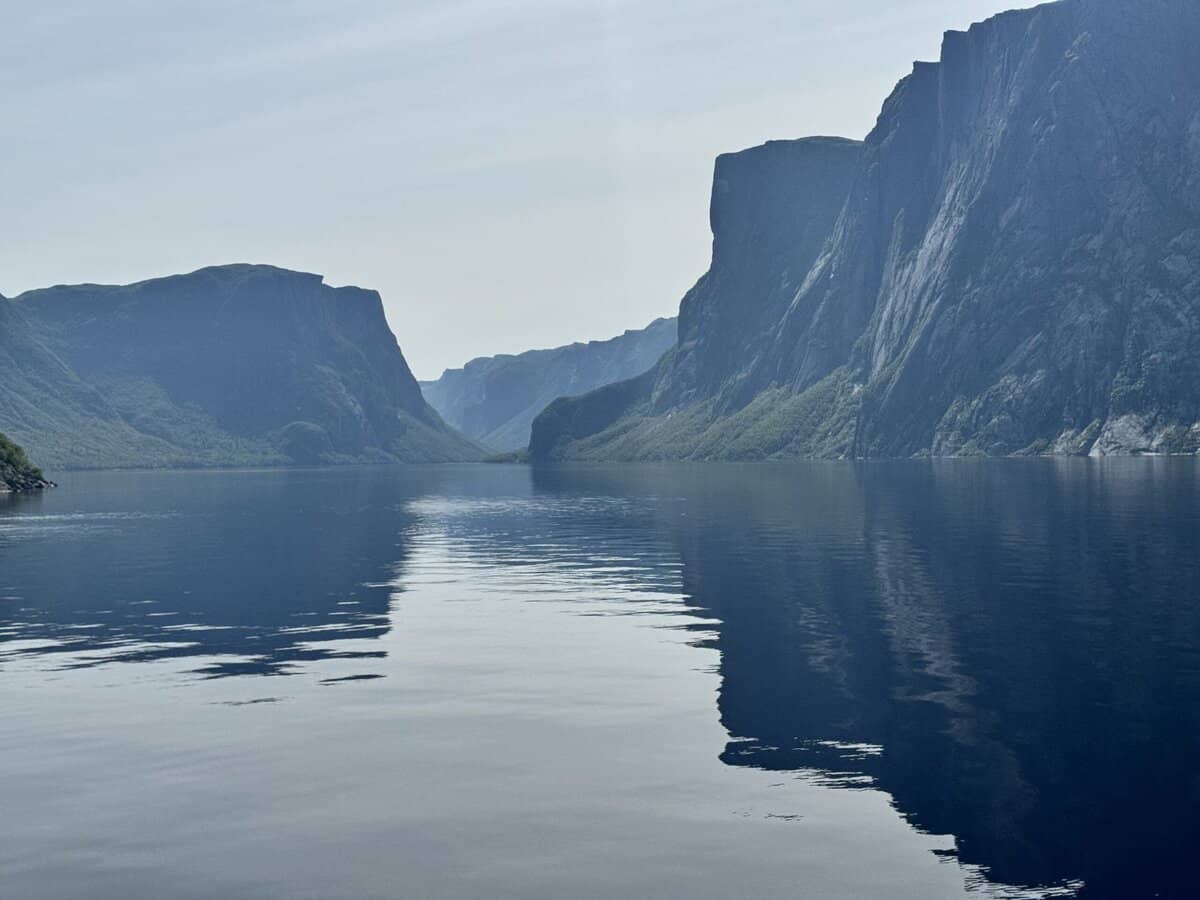
The boat ride was interesting, and I learned about how the fjord (which apparently really isn’t a fjord in a traditional sense since its land locked) was formed and some of the more interesting tidbits of natural history surrounding it. At the tour’s turnaround point about an hour in, it was time to depart. The father-son duo from my orientation were also on the boat, and we’d chatted on the way out a bit. It was nice to have some familiarity with other people I’d be on the route with, in case any of us ran into trouble.

As we hopped onto the dock, one of the dock workers swatted at a fly circling his head aggressively. “Hope you brought plenty of bug spray. They’re as bad as I’ve ever seen this year.” At least twice on our shuttle drive, Ivan asked us if we’d all remembered our bug spray, too. And the two young guys at the visitor center yesterday had likened the insects on their adventure to “the plague.” I reached for my Sawyer Picardin lotion and lathered up my legs, face, and neck, hoping it would do the trick to deter them.
The trail started off gently and a worn path was initially obvious through the heavily wooded area. The father-son duo and I hiked together, and I learned they were relatively new to backpacking. They’d completed the Fundy Footpath together in New Brunswick, and apparently it was a doozie of a hike—steep climbs and drops along the rocky coastline of Fundy Bay. I wondered what they’d say by the end of this journey. What would all of us say, I mused.
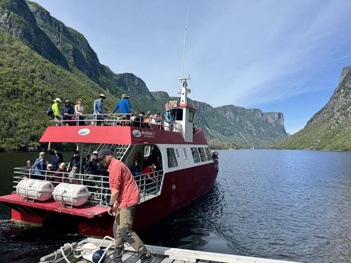
Eventually, the father and son slowed down and I continued on by myself. The young couple was behind me too, but I heard voices ahead. I soon discovered they were from a guided day hike. For the price of $325 CAD, there are two guided services that will lead you to the iconic lookout point over Western Brook Pond at the top of the gorge before retracing your steps back to the boat dock. The group stopped at a small pond so I continued past them, unsure if I’d regret the decision once the path became less obvious.
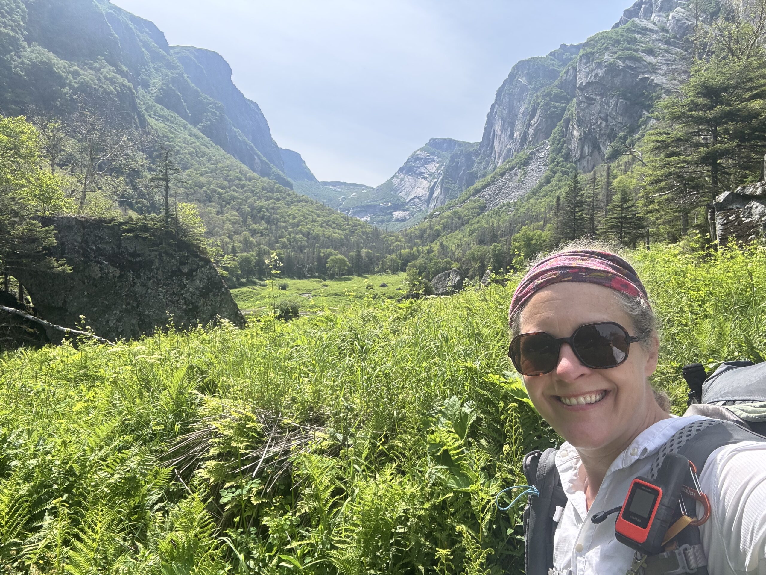
The path gradually became less clear, and I found myself having to backtrack if I reached an impassable area, usually caused by an enormous boulder wall. We’d been warned about a rock slide that happened over the winter and were given loose guidance on how to navigate around it to avoid putting ourselves in a vulnerable position since the rocks at the base were likely still unstable.
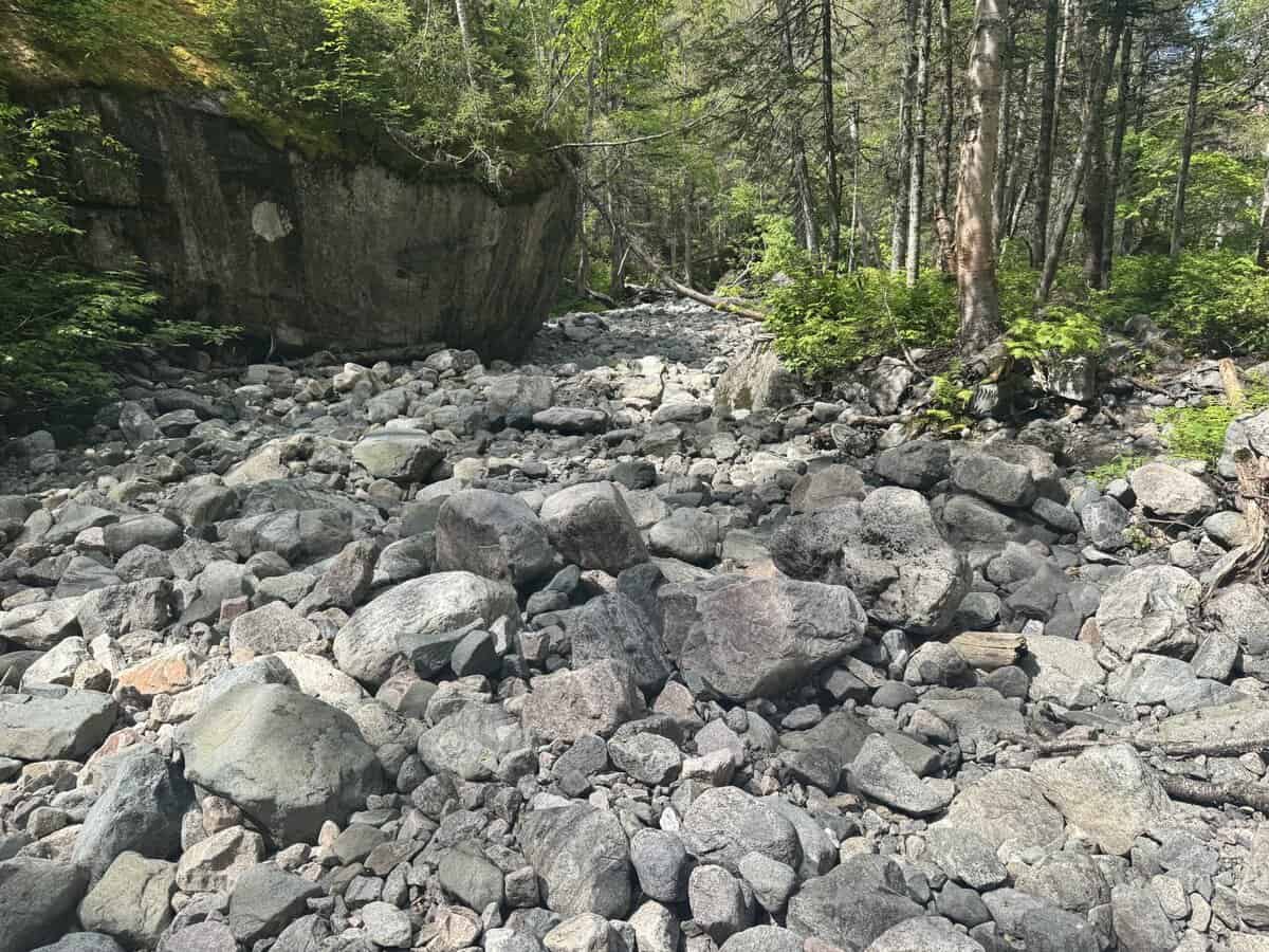
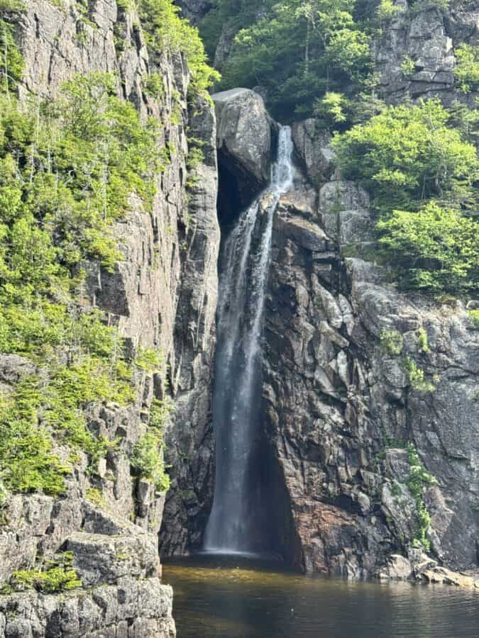
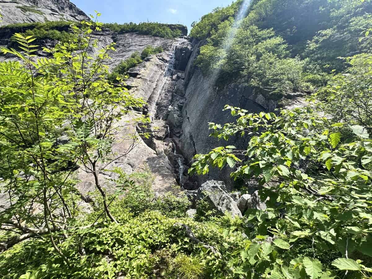
There was no question when I reached the area when I saw orange flagging tape marking the recommended route, the only markings I’d see on the traverse. I stopped briefly at the waterfall below the rockfall but decided to keep moving quickly, so I could enjoy myself at the iconic viewpoint before anyone else got there. Until now, the climbing had been manageable, but I knew I had some steep terrain above me.
As I traversed the rock slide, three points of contact on the rock helped with stability. I was grateful when it ended though and I didn’t step into a deep hole between the loose rocks. I continued climbing, drenched in sweat from the humid air and steeper pitch. The insect population began making itself known, too. But I was in good spirits, even if I was still nervous about the terrain ahead and navigating once I reached the top.
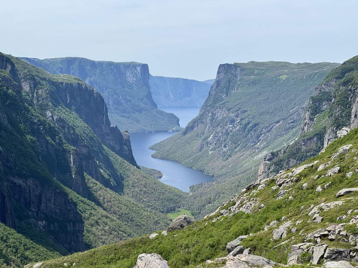
Finally, I popped out onto a long slab of rock which continued leading upward. I turned around to take in the majestic view of Western Brook Pond below me, and that’s when I realized I couldn’t have picked a better weather window. Completely lucky, but I’ll take it!
There was a group sitting on some rocks above me enjoying their lunch. I wondered which one of the people was their guide, because none of them were very friendly, despite me trying to strike up a conservation. They looked tired. I decided to keep ascending and sit in a different spot to sit and eat my lunch, to give them space.
While I was continuing to climb, a young, fit guy popped out of the woods below the rock slab. He was wearing a bright orange shirt that looked official.
“Looking for the route?” he asked me, jovially.
“Not yet, but I’m assuming you’re on it?!” I asked, trying to sound confident, despite the fact that I would have blown right by this spot, never guessing it was where I should enter the woods again.
“Yep, and it’s also a great place to hide for a moment of privacy when you’re leading a group,” he answered, smiling.
“Are you doing the traverse?” he asked. “Uh huh!” I replied, once again trying to sound enthusiastic instead of nervous.
“By yourself?” He asked.
“Yep!” I replied.
He put out his fist to bump mine and exclaimed excitedly, “Nice! How about I take your picture before you continue. I’m guiding the group down there and you can be my model for where they can stand for their photo ops.”
I was so grateful for this kind offer, knowing it would save me the trouble of trying to stage a shot with my phone’s timer, which would inevitably take a dozen tries to get right. “That’s so kind of of you, and I’d love to!” I replied.
Garry the guide showed me and his guiding group at least half a dozen ways to pose on the rocks. I didn’t want to take up much of his time, so I opted for the two easiest poses he showed us. He took my photo and I thanked him profusely for the kindness. “Look for me on Instagram and tag me if you post those photos,” he said happily. Garry was meant to be a guide, and this group was fortunate to have his infectious good energy and enthusiasm. After finding him on Instagram, I learned that he’s also on a search and rescue team and ski patrol. He’s my kinda people!
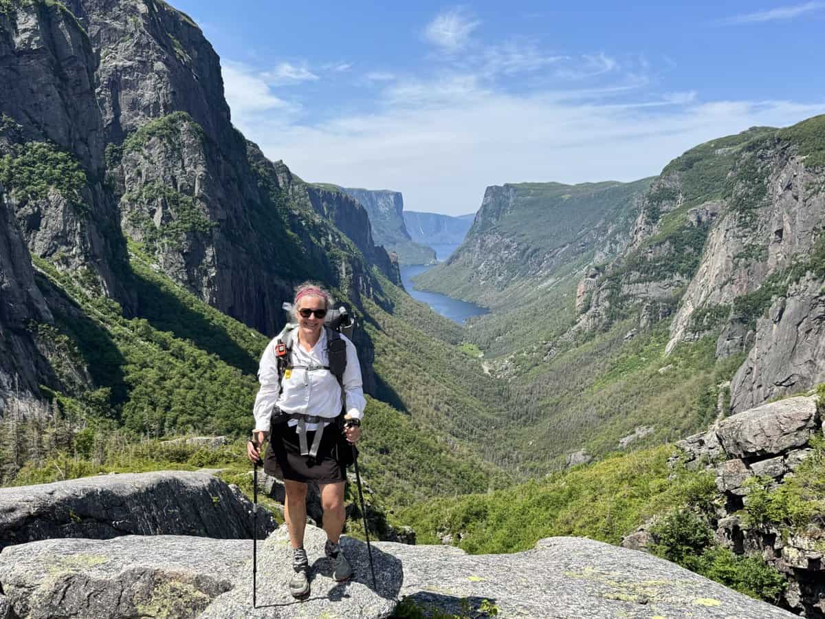
As I continued climbing upward on the rocks toward the plateau which would be my stomping grounds for the next 2-3 days, I stopped briefly to sit and enjoy the view below while I filtered some water at a stream that was running down the rocky face. I quickly ate my lunch because I noticed the bugs were picking up in numbers and they liked my sweaty body. They still weren’t unbearable though.
Despite the rest of the climb to the ridge looking fairly obvious and open, I found myself backtracking in a couple of different spots. What looked like a clear path would turn into a cliff face or vegetation nearly as tall as me. It was obvious that once the guided day hiking route ended, any semblance of a path also disappeared.
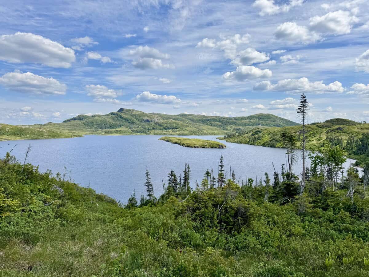
When I reached the top, the expansive landscape opened before me. It was gorgeous. Deep blue ponds dotted the scene, surrounded by grey granite, green trees and vegetation. I pulled out my map and compass along with my phone to chart my course.
I’d downloaded a GPX file from the park service that provided me with a series of waypoints, such as campsites, and more obvious geographical landmarks to aim for. My Gaia GPS app also provided a layer with a marked route. To an unsuspecting it looked legit enough to be an official trail, even labeled “Long Range Traverse.” Unlike All Trails, which would make me worry about inaccurate crowd sourced information creating this dashed line of a trail, Gaia is typically more authoritative. I decided to use it as a rough guide, if my own attempts at navigating with map and compass got me into impassable areas.
It didn’t take long to work myself into a pickle. Instead of sticking to the ridge, I surveyed the scene before me and decided it looked easier to get closer to the first pond below me and skirt its edge. To stay high felt like it might push me into a rock cliff face that I’d have to descend through dense vegetation to get around.

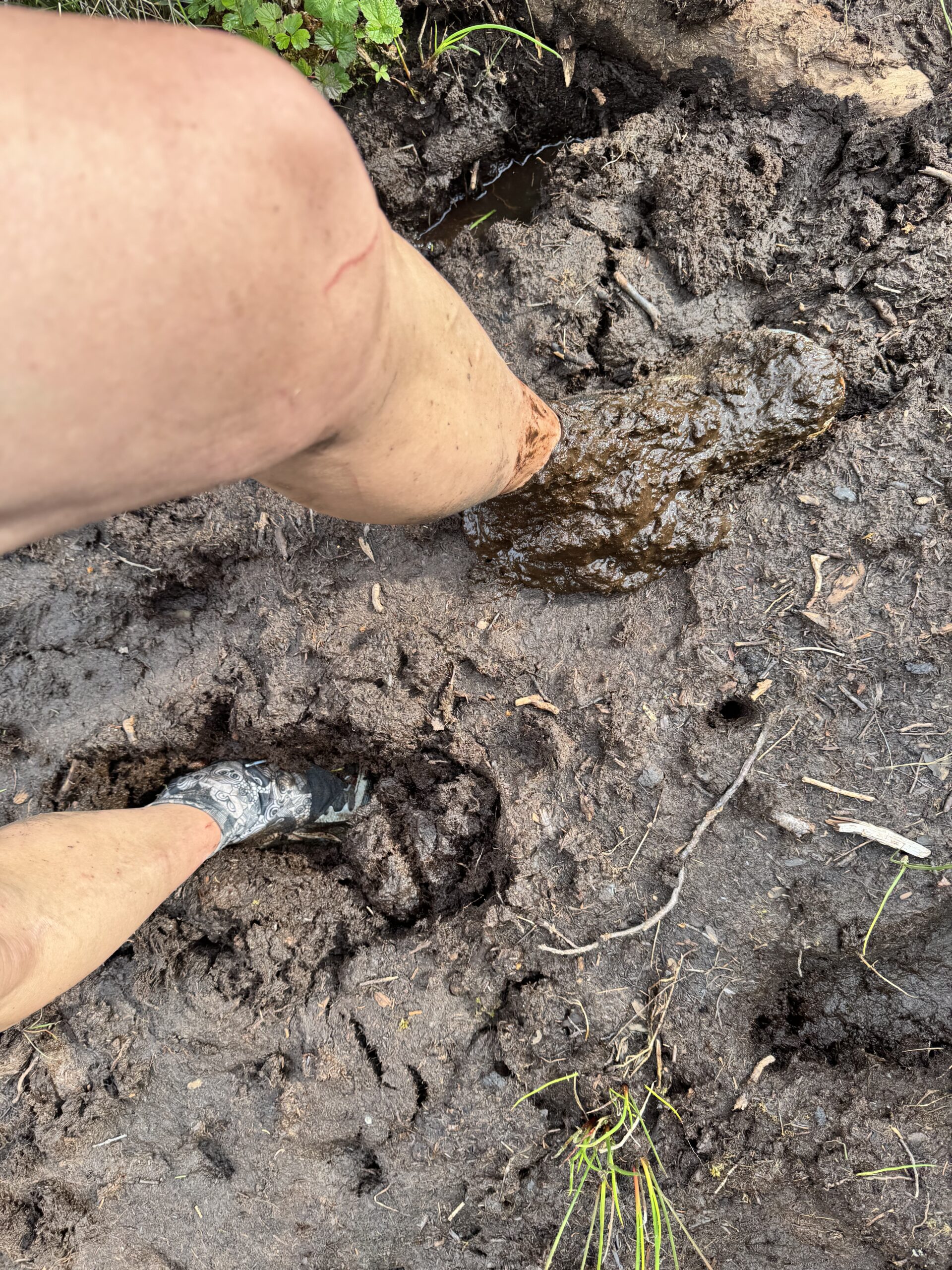
As I made my way to the pond, gnats swarmed around me like a cloud all of a sudden. As I descended the hill quicker to try and get away from them, I fell hard on my butt and slid a good five to six feet through slick mud. I find it amusing that my immediate reaction was to look around and make sure no one saw my awkward fall and slide. Thankfully, only my ego was bruised and my butt dirty, so I picked myself up and vowed to be more careful.
I looked up the hillside again and noticed tent platforms which was reassuring. If I could just climb to those, surely there was a worn path leading from them, I thought. I didn’t even have to go that far to find a faint trail. It disappeared as quickly as it appeared, but I could eventually see my next landmark, Little Island Pond, to help guide me.
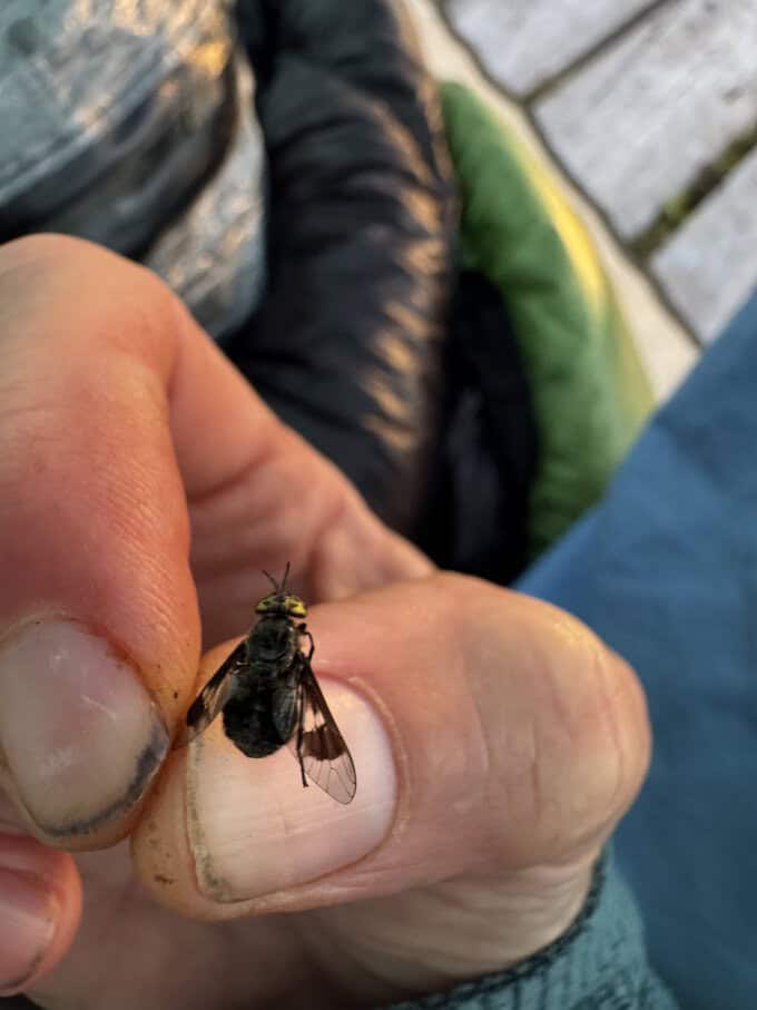
The insects, particularly flies, were beginning to swarm my sweaty head. A couple bit my legs and they hurt as much as a horsefly. “Damn it, you assholes!” I exclaimed as I swatted at them. Gnats started dive bombing my face, getting caught in my eyelashes constantly. I even started inhaling them through my nose and mouth as they became more prolific. The flies especially loved my ears and I was bitten several times behind them and even on my ear lobe’s upper edge. They also loved biting the area of my left leg with a floral tattoo, oddly.
Finally, I stopped to pull out my bug net, which I was using for the first time as my ZPacks Duplex’s stuff sack, thanks to the counsel of my good friend Chris. Otherwise I don’t think I’d have had it. It provided instant relief from the little jerks attacking my face, but they still declared war on my exposed legs. And it was challenging to hike with the net over my head since it obscured my vision. I remembered my umbrella and popped it up over my head. In my home turf of the Smokies, it almost always deters insects from swarming my face. Newfoundland insects didn’t get that memo though. They were relentless!
I hiked at as fast of a pace as I could safely manage, always keeping in mind that I needed to check my position regularly. I only got off course significantly one more time, climbing what was a very obvious path for a good half mile before realizing it was going in a different direction than my course.
I reached the tent platforms at Mark’s Pond too early in the day to stop without baking in my tent (because I sure wasn’t going to sit outside for any length of time with the insects!). So I opted to continue on to Harding’s Pond after taking a quick break. It was supposedly the prettier of the two campsites anyway. It was “only” about 3.5 more miles to get there.
The rest of the afternoon was frustrating with the insects. It was nearly impossible to enjoy the scenery for more than a few seconds. I want to say I handled the frustration well, but I felt like screaming for much of it. And I thought the navigation would be my greatest challenge!

And to be sure, the navigation was challenging at times. But “insect plague” was feeling more and more accurate. To add insult to injury, my legs began cramping. I’m sure it was because I wasn’t drinking enough on the humid, hot day, nor had I added electrolytes to any of my water. I was sweating profusely, assuredly losing sodium and potassium at a rapid rate.
On a couple of occasions, I flushed a grouse and her babies out of the nearby bushes. The babies would run into the woods each time, but the mama would charge me and then run ahead on the trail. It would have been a comical scene if I didn’t know this mama was stressed. “Hey, it’s okay. I’m a mom too and I would never hurt your babies,” I told her, as if she could understand.
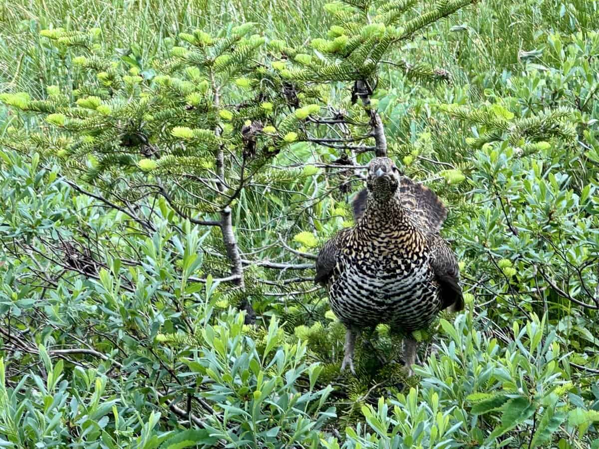
Eventually, I couldn’t stand still another moment. The insects were taking full advantage of my vulnerable position, swarming and biting me even more. I followed the grouse down the trail, which she traveled for far longer than I’d anticipated. Her babies were waaaay behind her now!
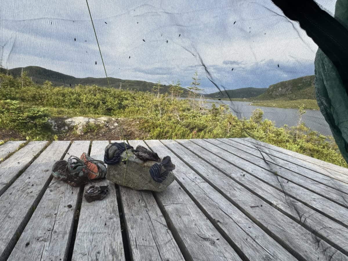
Finally, and mercifully, I arrived at Hardings Pond. The prime tent pad was taken by what appeared to be a man and woman. In the distance, I could hear them conversing casually, sitting on the edge of their platform to enjoy the view behind it. They didn’t seem the least bit bothered by the insects, but they had nets over their heads and were covered in head-to-toe clothing. Maybe they were just had more tolerance for them than I did? I gathered some water from Hardings Pond and climbed a hill that looked like it might hold a tent pad with a view, too. It did.

I went to work setting my non-freestanding tent up, using rocks as anchors. It was a bit of a struggle to find big enough rocks to do the job, but persistence paid off. Meanwhile, ten million insects swarmed me, taking every opportunity they could to land on my exposed skin. The mosquitoes were arriving on the scene, too. So far, I’d only been bit by what appeared to be deer flies (“Stouts” as they appropriately call them in Newfoundland). The mosquitoes were going to pack a different punch, and I could already feel a couple biting me. As soon as my tent was up, I dove into it, bringing a large and diverse insect population with me.
The bugs moved too fast to kill, so I laid down on the floor of my tent, not even taking time to blow up my air mattress–I needed a few minutes to decompress. Except my body wasn’t having it. My calves cramped hard in unison acutely. I jolted upright to grab them, which then triggered cramps in my hamstrings. I wanted to howl it hurt so much, but I also didn’t want the nearby party to hear me and think I was in distress. I mean, I was in distress, but it was “just” cramps.
After forever and a few moments of silent panic when I thought they’d never end and I couldn’t seem to rub or flex any of them out, they let up one by one. I could tell they’d get triggered again by the slightest movement though. I knew electrolytes and water were the only things I could probably do to stave them off, so I carefully reached for my pack at the foot of my tent and found a sleeve of electrolytes in my food bag.
I hated having to drink so much, only because it meant I’d have to leave my tent to pee. I also grabbed my full bag of Cheetos. Looks like they’d be my dinner if I couldn’t cook without being eaten alive. I ate half the bag and didn’t think twice about gorging on crap–they are my most treasured comfort food in the backcountry (and at least they’re salty, which probably helped ward off more cramps).
Finally, I changed out of my sweaty hiking clothes and began putting my sleep clothes on. But this triggered more cramps, even in my diaphragm! I’ve never experienced as many violent and frequent cramps as I did that night. Two hours later, I’d killed most of the insects in my tent. Turns out, they run out of steam eventually and they were easy to smash against my tent wall. I gathered them in a pile on the floor to scoop up and dump out later.
When my bladder wouldn’t let me ignore it for another second, I emerged from my tent and decided to cook up some ramen if I could stand it. I had hoped the breeze had picked up enough to help with the insects, but no luck. As I was taking my first bite, a particularly obnoxious fly started flying in front of me. As I swatted at it, I knocked my food cozy out of my hand and spilled the bulk of my hot ramen broth right into my lap!
I’ll leave out the string of expletives that came out of my mouth. This was not my finest moment of coping with a positive mental attitude. The noodles had mostly spilled out of the Ziploc freezer bag they were in, but thankfully the cozy contained most of them.
Once I cleaned the mess up as best as I could, I realized I couldn’t eat a bite without ingesting insects too. So I crawled back in my tent to eat there. I peeled off my Smartwool underwear and replaced them with my wind pants. I almost opted to just sleep with my food, but my conscience wouldn’t let me. So I climbed out of the tent one more time to take my food bag and sleep pants down the hill to the food storage locker.
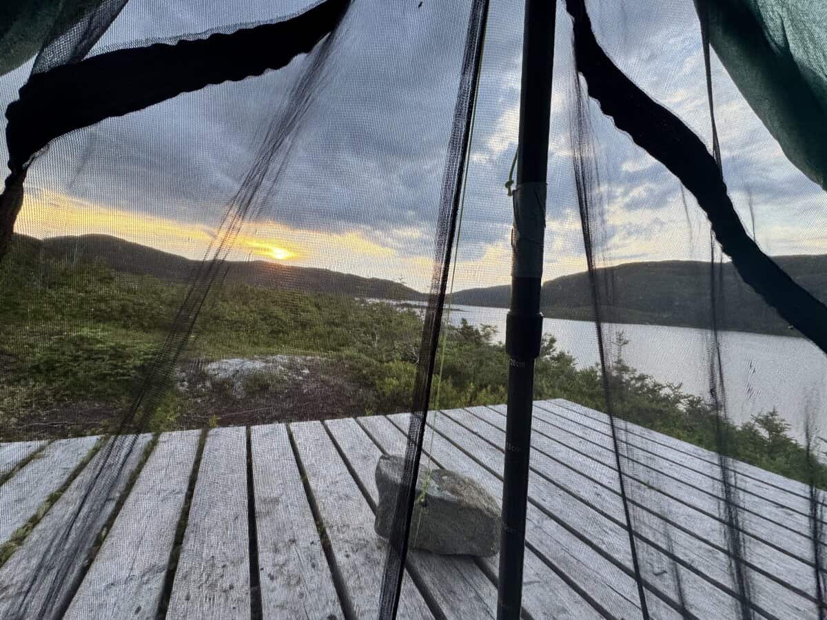
Once back in the tent, I tried to enjoy the wash of colors as the sun set over the pond. It had been such a challenging day mentally and physically with the cramps from hell. I messaged Larry on my InReach that I was okay. I also told him I would finish the route tomorrow, come hell or high water.
Seeing as how everything feels worse at night, whether it’s physical or emotional turmoil, I knew I couldn’t trust my feelings completely. My permit allowed for me to stay out two more nights. That was a decision best made in the light of day though. I did my best to drift off to sleep while the sun continued its slow drop below the horizon
Excellent honest storytelling, as always, Nancy! Flying/biting insects are the worst. A similar scenario on Cumberland Island GA on an unseasonably warm and muggy weekend made us abandon our backpacking trip a day early. Your photos are amazing and I look forward to reading Part 2.
Oh my….those bugs! We were on PEI with friends a few summers ago and I experienced a walk in the woods where I was warned about the swarms. I covered head to toe in clothes, but they were still able to penetrate, I can’t imagine backpacking with them. Sounds like it was a beautiful area though! Loving your blog!
Wow! What a tough first day. I hiked The Long Range Traverse with my family last summer. I was so concerned about the bugs that I invested in Insect Shield clothing for all of us. They were a lifesaver! Socks, hats, shirts, and pants. I think it was probably a light week for bugs, but whatever was there didn’t bother us at all. It was amazing !!Thanks for sharing!! The pictures are awesome- and brought back a lot of memories. ❤️Looking forward to reading part 2.