The following is a trail journal of a 17.7 mile loop hike, combining the following trails in Great Smoky Mountains National Park: Jake’s Creek, Panther Creek, Lynn Camp Prong, and Miry Ridge Trails. I completed this hike on a warm summer’s day in July as a solo venture. Details about the hike itself with mileage, my Gaia track, and other pertinent details can be found at the end of this post.
Trail Journal
The previous day, I hiked a network of trails in the area and spent the night in Elkmont with my good friend and SAR team member, Lane. We rise early to start our respective adventures for the day. Lane is leading an off-trail hike from the Miry Ridge Trail through the Great Smokies Hikers and Adventurers MeetUp Group and my own hike will share the same trailhead.
We head to Jake’s Creek and join the rest of Lane’s hiking companions. I already know and adore one of them, Amy, but I’m happy to finally meet two new people I’ve been corresponding with recently about hiking together and gear. Steve and Cindy are as nice in person as they are through written correspondence, and I’m glad we get to share the first few miles of trail together before we head in separate directions.
We make good time up Jake’s Creek Trail. It’s amazing how much more quickly an uphill stretch goes when you’re in the company of fun people. I take a quick photo of them at the top, and they’re off into the wilds of the park, far removed from a designated trail (they’re hiking on decommissioned trails that are now all but visible from where they once traversed).
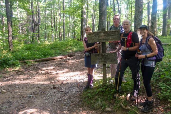
Lane and crew
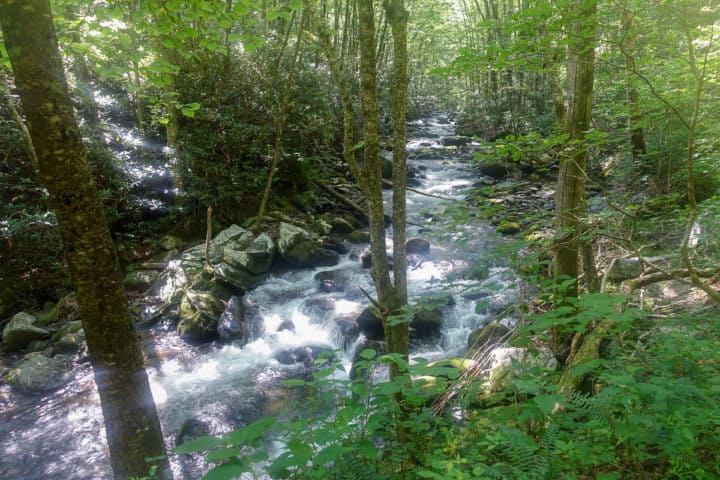
I head down Panther Creek Trail and reach the Middle Prong River in good time and make the ford across it. What a difference six months makes in my response to the cold water–it’s absolutely refreshing today and not at all too deep to worry about crossing it safely.
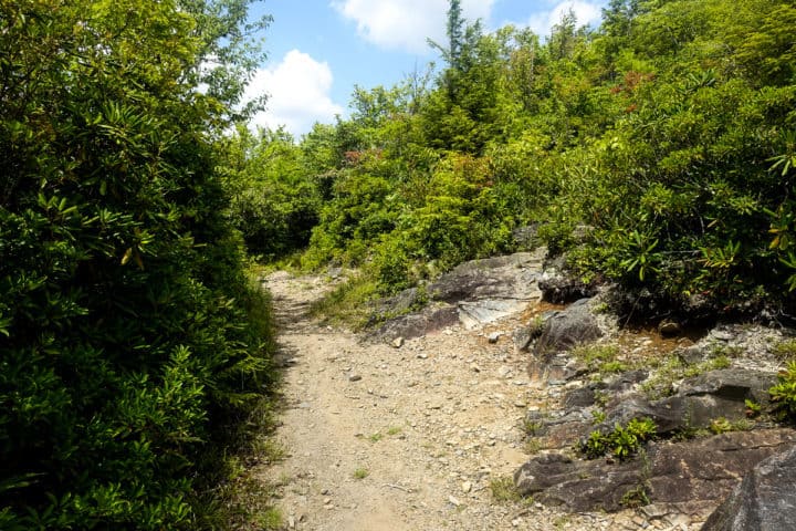
I start heading uphill again and soon meet the Lynn Camp Prong intersection. I hang a left and away I go, the trail gently climbing at first and gradually gaining more elevation in the last two miles. The cicadas are really loud and the air is muggy and hot, so I’m profusely sweating and fully expect to find chafe burns on my back when I get home. Oh summer, I have such a love/hate relationship with you on the trail!

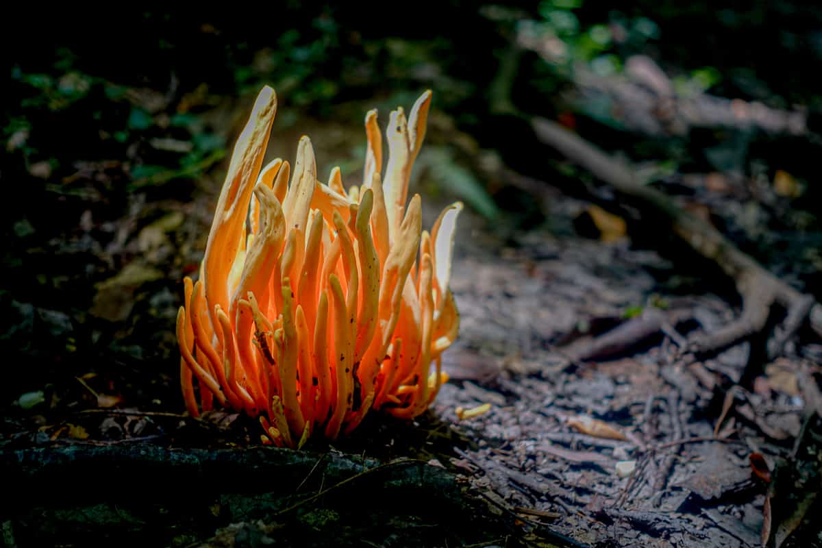
This coral fungus looked like a campfire with the light shining through it!
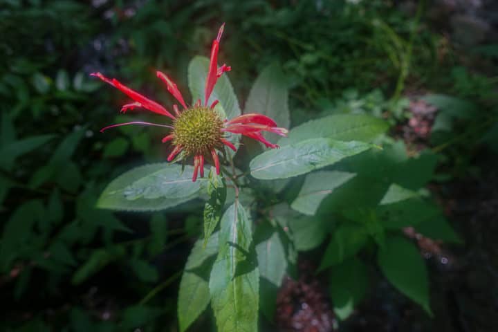
Bee Balm
Before starting any hike in the Smokies, I always like to read about the trails in my favorite guide, Hiking Trails of the Smokies (a.k.a. “The Little Brown Book”). I read that I might hear the scolding chatter of red squirrels as I get closer to Miry Ridge and that bear sightings are common too, as they forage on the abundance of cherry trees in the area.
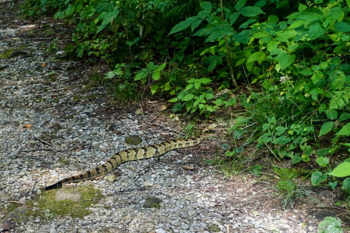
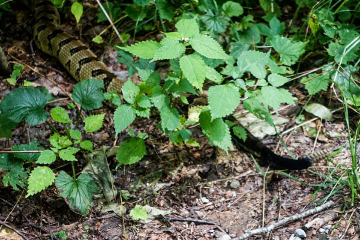
I don’t ever hear the characteristic chatter of a “boomer” (red squirrel), but I do hear what sounds like a chorus of cicadas near my feet as I’m ascending. Except I know it’s not cicadas, but it takes a second for my brain to catch up with my senses. I look down and I’m standing beside a Timber Rattlesnake who is curled up beside the trail, giving me a stern warning.
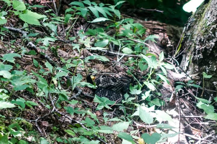
See him in there?!
I immediately bolt forward a few steps, but am looking from side to side quickly, in case he has friends nearby. I don’t see any, so I try to calm my shaky hands to grab my camera and take a few photos and video. He rattles at me the entire time, never taking his eyes off me for a second. I thank him for not striking (because he certainly could have reached me, had he wanted to) and move on while scanning the sides of the trail constantly now!
I imagine him going home to his den that evening, telling all his snake buddies around the campfire, “Dude, I scared the hell out of this one lady! I really nailed the cicada impersonation and thought she was gonna crap her pants when she looked down!”
Here’s a short video I made of him rattling, so you can hear what it sounds like:
Not 100 feet after the snake encounter, I hear the stirrings of a big animal in the brush below the trail. I see the back of a bear galloping down the hill, undoubtedly startled by my presence. Well bear, that makes two of us that got spooked today! I holler down to him, “Sorry about that, big guy! I know how ya feel right now!”
I finally reach Miry Ridge and head back towards Jake’s Creek, a bit jumpy with every root I see that resembles a snake. A trail runner passes me along this stretch, and I’m thankful I’m not the only one on this stretch right now!
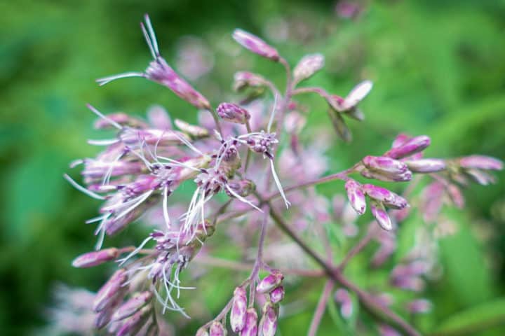
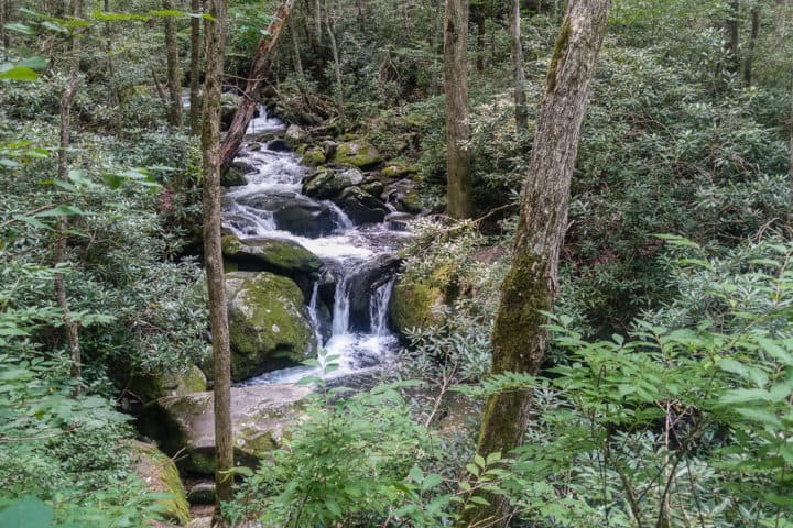
I really like the Miry Ridge Trail–lots of beauty along the way.
I come to Jake’s Creek and it looks just like it did when I left it this morning, minus my friends posing at the trail sign. I head back down the way I came, and the walk is mostly uneventful…until I see yet another rattlesnake! This one is stretched across the trail and is lazily making its way across. It never rattles at me, and I like how chill this one is compared to the first one I saw. I take some photos (from a safe distance) as it makes its way across and slithers into the woods.

I reach my car and laugh at the good fortune of coming across three rattlesnakes in one weekend with no consequences other than an adrenaline rush (the third was seen on the Blue Ridge Parkway on my drive to the Park, but sadly it was dead after a car hit it).
Lane’s car is still parked beside mine, so I leave him a quick note to tell him I’m off trail, that I saw two rattlesnakes, and that he needs to text me when he’s safely off trail too (God knows what they could run into on an off-trail hike where snakes are more likely to be found)! He texts me later than evening to let me know they had a great hike (no snake sightings) and that they came across another hiker who also saw my little rattler friend on Lynn Camp Prong!
This has been an epic summer for snake sightings, both from my own eyes and many of my friends. Wildlife biologists in Virginia predicted it would be this way because of our mild winter last year. I’d say they nailed the prediction!
Be safe out there friends, and If you’d like to learn more about snake safety while hiking (the types of venomous snakes in North America and how to tell them apart, how to avoid snake encounters and what to do if you are bitten by one), head over here for the article I wrote about this topic.
And if you’d like to further your knowledge with all sorts of things pertaining to wildlife, I highly recommend Wildlife For You which hosts regular webinars on all sorts of topics. It is an excellent resource for hiker/outdoor education (and it’s just downright fun to learn about all the critters of the forest from the great biologists who teach the classes)!
TRAIL REPORT CARD and GPX TRACK
Mileage: 17.7 miles
Type of Hike: Loop. This hike could also be completed as a “lollipop” loop hike, beginning on the Middle Prong Trail.
Potential Hazards: The water crossing at the junction of Panther Creek and Middle Prong trails can be dangerous in high water. For your own edification, The “$1 map” of the Smokies has a very helpful list of all the streams in the Smokies that may be difficult and/or dangerous with high water during or after rain. It’s wise to consult this list before any hike, to see if you might be faced with turning around unexpectedly!
Suitability for Kids: This was a longer hike than most kids would enjoy, and there aren’t a ton of “cool” features for them to take in, necessarily.
Dog Friendly: No. Dogs aren’t allowed on trails in Great Smoky Mountains National Park with the exception of the Gatlinburg Trail and the Oconaluftee Visitor Trail.
Permits: No permits are needed to hike the trails in Great Smoky Mountains National Park, but they are required for camping in the backcountry. Reservation information for backcountry website the park’s website. And clearly, you shouldn’t park in the Cade’s Cove Picnic Area if you plan to backpack this route.
National Geographic Trails Illustrated Map of Great Smoky Mountains National Park

I carry the 10 essentials in my pack at all times and you should too! If you’d like to know what gear I use and recommend, here’s my gear list. I also invite you to join my Facebook Group, where I not only post the best deals on quality gear that I can find, but I also provide education on backcountry safety topics via Facebook Live events. It’s a fabulous group of people and I like to think of it as one of the nicest Facebook groups out there. 🙂
My Gaia Tracks from This Hike
If you are interested in using Gaia, you can get a 20-50% discount off a Gaia subscription (and I highly recommend it). I use it for both SAR and personal use exclusively.
[content-upgrade id=”3163″]