I woke with a smile on the seventh day of the trip, still enamored with my very special camp spot. I took my time getting ready for the day, since I didn’t have to be anywhere except an orientation at the Gros Morne National Park Visitor Center at 2:30 p.m.
The ranger-led orientation is required for anyone wanting to backpack the Long Range Traverse, and the park service won’t hand off your permit until you attend it (and you only have one shot to attend, which is at 2:30 p.m., the day before your trip starts). I’d applied for the permit to hike the Long Range Traverse months ago, since I knew they were scarce and coveted.
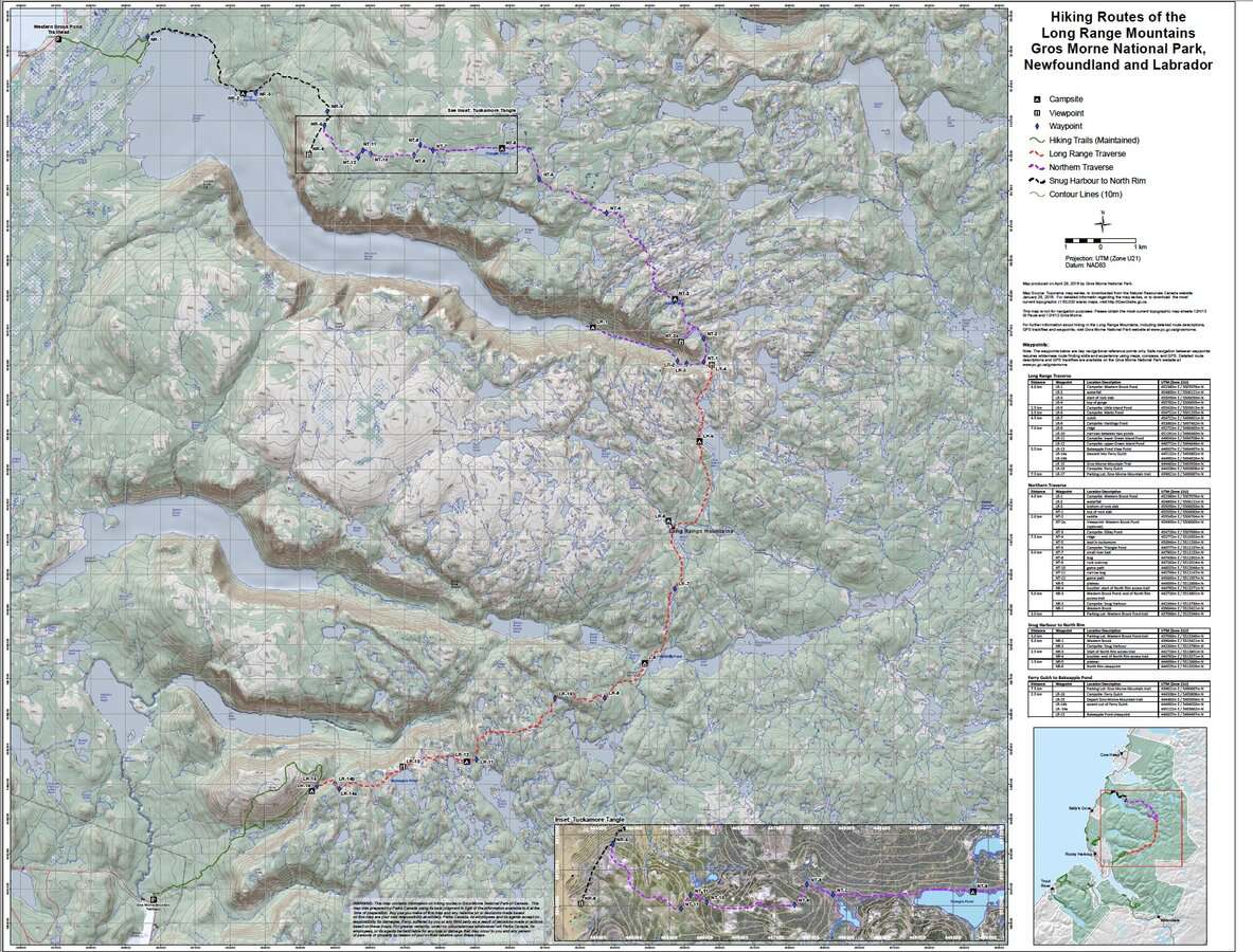
So what is the Long Range Traverse, you might be asking? It’s a hiking route in Gros Morne National Park on Newfoundland’s west coast. The Long Range Mountains are actually the northern terminus of the Appalachian Mountain Range! Here’s more information from the Canadian National Parks website, including the permitting process, if it interests you.
I’d learned about this route last September when I was finishing up my East Coast Trail thru hike. I wanted to return to Newfoundland to backpack more, and this felt like the perfect next trail….or, should I say, route.
The 30-km(ish) Long Range Traverse is entirely off trail and unmaintained, which probably explains why the park service takes it so seriously and requires hikes to attend an orientation before they allow them to start it. I’d read varying reports about the orientation and what it entailed. I couldn’t discern if it had evolved over time, or if it was tailored to the experience level of the hiker attending it.
I’d watched enough YouTube videos to know that there was a worn path in some areas of the traverse and a smattering of campsites with pit toilets, wooden tent platforms, and food storage lockers (none of which had been maintained in quite some time). If anything, they were reliable waypoints to aim for along the way.
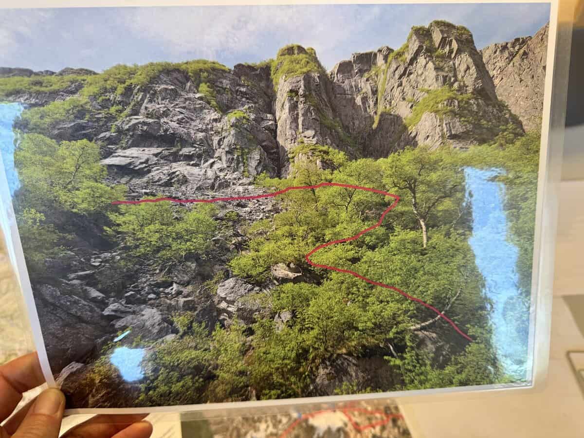
But since the route is unmaintained and was never intended to be a trail, there are plenty of areas where there isn’t a worn path. People often follow game trails unknowingly off course.
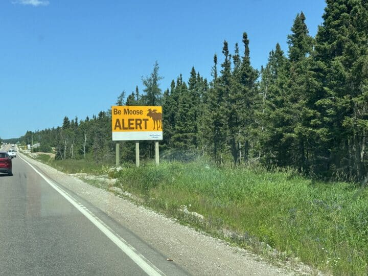
I also knew the terrain would be incredibly challenging–boggy, muddy, steep in places with dense stands of tuckamore (stunted groves of evergreen trees). The area is a moose and caribou habitat too, and it’s not uncommon for hikers to see an ungulate or two. I was both excited and intimidated about the prospect of this adventure (especially by myself). The “choose your own adventure” style of hiking really appeals to me, but I also recognized that taking this on solo inherently carried more risk.
As I drove toward Gros Morne, I ran through the basics of map and compass navigation in my head. I sure didn’t want to embarrass myself in front of a park ranger by not passing a test. Plus, I wanted to do the traverse “old school” style as much as possible, keeping my phone and Gaia GPS app tucked away unless I felt like I was way off course.
I’d heard rumbles that the navigation test wasn’t required anymore, but I didn’t want to take any chances. With the advent of digital navigation apps that people relied on so heavily now, perhaps the park service gave up trying to encourage (mandate?) map and compass knowledge before issuing permits.
The orientation turned out to be far less intimidating than I’d expected, but also not as helpful as I’d hoped either. The ranger, a young woman probably in her mid twenties, was impressed that I was going at it alone, confessing she’d never do something like this by herself. Nothing about her praise made me feel confident though. Was I being foolish to go alone? The other people in the orientation with me were both paired up—a boyfriend/girlfriend and father/son.
Using a different map as our guide, where the route was printed in a series of dashed lines like a trail would be, we were instructed to draw the route by hand on a similar map we’d bought from the park service (unless you’d brought a map from home).
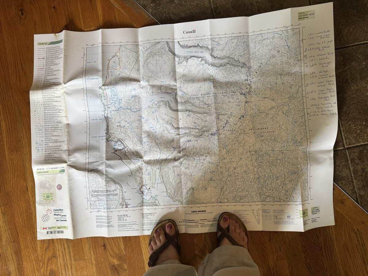
I suppose the exercise was meant to be helpful since it forced us to study the park service’s map in detail as we drew the route on our maps. But I think it would have been more useful and helpful to offer the preprinted map for purchase instead, and preferably at a larger scale than 1:50,000.
After we drew our routes, we watched a 20-minute video which basically conveyed the following:
- You’d better not only rely on technology and know how to use a map/compass together (or alternatively, have another device with navigation capabilities as a backup)
- Help will not be fast if you get lost or injured, and you’ll likely be plucked out by a helicopter if you need it.
- Multiple people have to be rescued every year from the route.
- You need to check out a satellite SOS device from the park service if you don’t already own one.
- You need to let the park service know when you’re off trail or the rangers will come looking for you the day after you stated you should have finished.
If I was a little nervous before, I was now at the height of my anxiety about doing this alone. Did I really have the skills to get through it safely? I knew the physical challenge was within my abilities. Off-trail hiking can be painfully slow and challenging sometimes, but I’d given myself 3-4 days to complete it. It felt like enough, but was it really?
And what if my phone stopped working and I had to rely on the less-than-ideal map? It was good enough and it would have to do, but I was kicking myself that I didn’t create and print maps using CalTopo at home. While having a map with a small scale like the one I bought was useful, equally helpful (if not more so) would be maps of each day’s planned itinerary with a larger scale and a bit more concentrated detail of the terrain I’d cover each day. Too late now.
I decided I’d mull it all over in camp that evening. I could always back out the next morning before taking the Western Brook Pond boat shuttle. Western Brook Pond is a land-locked glacial fjord, and a touristy boat tour is the only way backpackers can gain access to the start of the traverse unless they are with a guided service.
After the orientation (which did not include a navigation test!), I was issued my permit and reminded again to return it so the park service didn’t come looking for me. As I was leaving the visitor center, two young adult guys walked in to return their permit. “The bugs were like the plague up there!” I heard one of them tell the ranger. At least I had that covered with a full bottle of Sawyer Picardin and my head net. I was hoping they wouldn’t be as bad as this guys were conveying–maybe they hadn’t backpacked extensively enough to know how bad insects can really get on trails. There was only one way to find out for sure.
That night, I stayed at West Gros Morne Campground which was a short drive from where I’d meet my pre-arranged shuttle driver at Gros Morne Mountain’s parking area, which is where I’d end the traverse. From there, I’d be taken to the Western Brook Pond parking area where I’d hike in nearly two miles to the pond and boat shuttle.
I spread all my gear out on the site’s picnic table and packed what I needed. I was especially mindful of electronics, making sure I had my external battery charger fully charged and an extra cord to connect it to my phone, just in case the other failed. Redundancies matter a lot when the risk matters a lot. “I guess this means I’m going to give it a go,” I mumbled to myself as I topped off my water bottles and stuck them in the side pockets of my backpack.
That evening, I called Larry to remind him that he should expect to hear from me on the Garmin InReach each night. On rare occasions, messages struggle to transmit with a dense tree canopy, but that shouldn’t be the case with this adventure since it’s mostly in the wide open. No matter what, it was important he paid attention if he didn’t hear from me the two nights I was out.
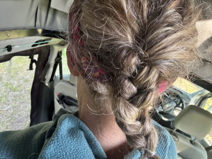
Then, I practiced french braiding my hair to distract myself from my anxiety. I’ve never mastered hair braiding on myself or anyone else. I still didn’t master it that night! Eventually, I tried to sleep but I tossed and turned all night, eager to get started, come what may…
I’m enjoying reading about your journey. My favorite part of this days description is the braid. It reminded me of the times Paige braided your hair for hikes. There is just something special about mothers and daughters. I’m sure you think of that often too.
I just gotta say, you are BADASS! And I love this bit of wisdom, “Redundancies matter a lot when the risk matters a lot..”
I’m on the edge of my seat to learn what happened next…..not just with your French (Irish?) braid but with this trek!!! Next day please!!!
It’s the start of a French braid at the end. Looks great!