The following is a trail journal of a 15.0 mile one-way hike, combining the following trails in Great Smoky Mountains National Park: Noland Divide, Pole Road Creek, and Deep Creek Trails. I completed this hike on a muggy day in August with two friends. Details about the hike itself with mileage, my Gaia track, and other pertinent details can be found at the end of this post.
Trail Journal
I am often a solo hiker, which I love. But as I’ve worked more diligently on completing “my map” of the Smokies, I find myself craving the company of others. I figure it’s time to spread my introverted wings and volunteer to lead a couple of hikes through the awesome MeetUp group, Great Smokies Hiking and Adventurers Group (GSHAG).
Leaders in GSHAG often develop quite a following, and I know I have stiff competition for folks to sign up for my hike versus some of those ones pitched by the more established leaders. No matter, I’m fine if it’s just me and Keen, my friend I’ve roped into going with me long before I posted the hike in MeetUp.
Safety Snippet: While I would be hypocritical to say you should never hike alone, it’s likely the safest choice; however, if you are an experienced, knowledgeable and well-equipped hiker, I personally think it’s acceptable. This is a widely debated topic though–just my two cents.
I’m so excited when my “social media friend” Jerry decides to join us! Jerry and I “met” through my Facebook Group, and I feel like I already know him, even before meeting him. Unlike some people I’ve interacted with online and am unsure if I’ll like them in “real life,” I know Jerry and I are gonna jive.
We meet at the Deep Creek Trailhead on Newfound Gap Road and leave Jerry and Keen’s cars, taking mine up to Clingman Dome Road and starting from the Noland Divide Trailhead. The air is cooler at this elevation, but it’s still muggy and the “car wash” effect of walking through overgrown vegetation lining the trail soon leaves us damp.
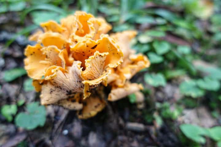
Chicken of the Wood (I think!)
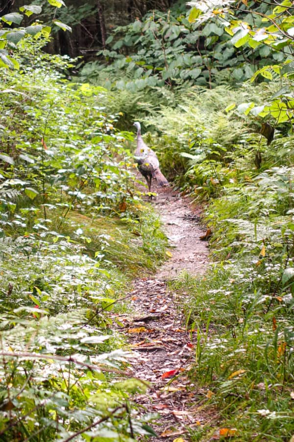
No matter, because we’re all hitting it off with good conversation as we work our way down the trail. A turkey is also working his way down the trail, and it’s fun to stop and watch him for a moment, before he ducks into the woods and leaves the path clear and free for us.
Safety Snippet: Even with animals like turkeys, it’s always best to stay about 50 yards away from wildlife, to give them their own space. No one likes a close talker. 😉
 ]
]
Northern Hardwood and Spruce Fir forests, typical of this elevation, are soon replaced as we descend into the lushness of Cove Hardwood terrain. Jerry and I are having a great time sharing our knowledge of all things related to trail botany, and it’s always fun to meet someone else who has developed friendships with the flora in the Park.
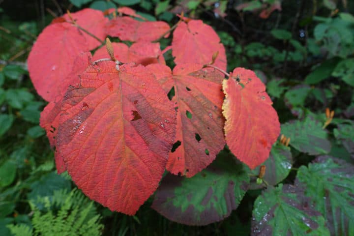
Witch Hobble
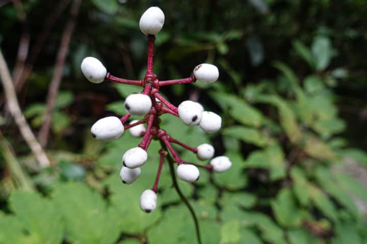
Doll’s Eyes (White Baneberry)
We reach Pole Road Creek Trail in quick time and continue our descent downward. At the junction of Noland and Pole Road, I’m reminded of a scene five months ago when I was backpacking the Benton MacKaye Trail through the Park with two other friends. I accidentally left my camera on a tree branch when we stopped for a break, and I didn’t realize it until I was nearly 3 miles further down the trail (and yes, I backtracked to retrieve it!).
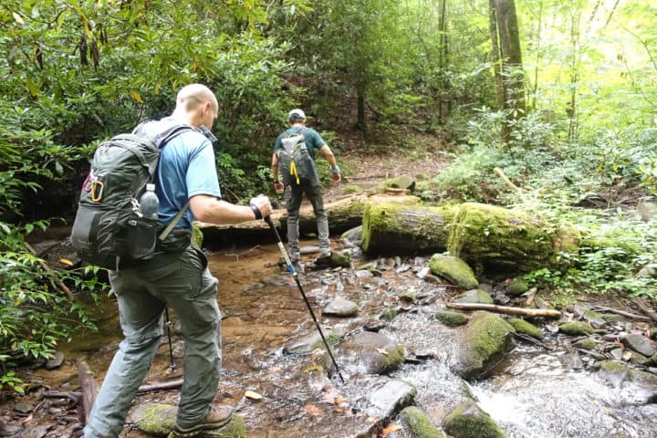
Pole Road Creek has several creek crossings. On several of them, Jerry and Keen are brave and traverse fallen logs perched higher above the water than I trust my balance for, so I trudge through below them in my trail runners. The water is refreshing, but I know it’s a temporary refreshment as I’m leaving them ripe for maceration and pain, secondary to water retention, if I were on a longer hike.
Safety Snippet: Always bring an extra pair of socks on a hike (and a pair of water shoes, if you really don’t want to get your shoes wet in stream crossings). I won’t go far into the debate of waterproof vs. non-waterproof shoes here, except to say that I only hike in waterproof shoes in very cold conditions. Otherwise, I want non-waterproof shoes on my feet since they dry faster after getting wet.
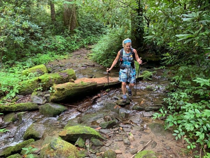
At least I could rock hop some of them!
100% sure I’d slip right off this thing into the water!
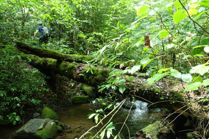
Keen is fearless on log crossings and doesn’t miss a beat getting over them (I can’t even get my camera ready fast enough before he’s across them!)
We come across a couple of hikers who are completing the Benton MacKaye Trail, and the woman of this duo has clearly not had much human interaction in awhile. She talks to us nonstop, hardly allowing a word in from any of us, and we get a good laugh out of the whole experience after she moves on. She is much older than a typical backpacker and her energy and enthusiasm are inspiring (although I’m not sure I would want to hike with someone who talked that much)!
We reach the wide, bridged crossing of Deep Creek and start our ascent up to Newfound Gap Road. But first, lunch. We stop at campsite 54 and enjoy our well-earned calories and then continue on up, refueled and ready for the challenge.
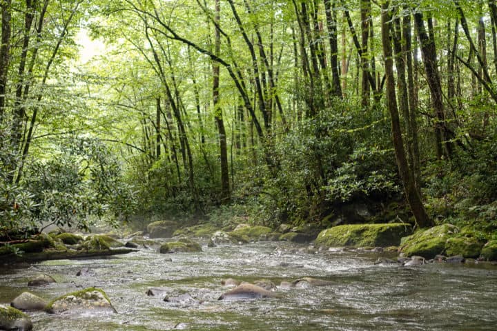
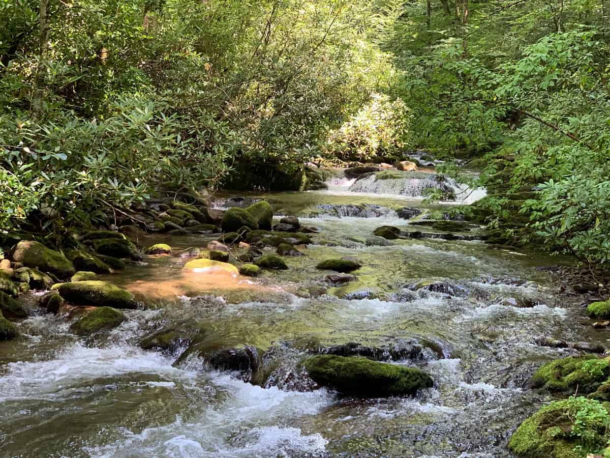
The unparalleled beauty of the streams of the Smokies
The trail parallels Deep Creek much of the way, sometimes skirting the riverbank so closely that I’m certain the trail would be covered by the creek in times of high water. Something to take note of on future hikes, for sure.
Safety Snippet: Make sure to check the “$1 map” you can get at visitor’s centers for potentially sketchy stream crossings before heading out on a hike. Ask a Ranger if you need some advice on whether or not you might encounter problems (or in some of the Smokies related Facebook groups who are a wealth of knowledge for questions like this).
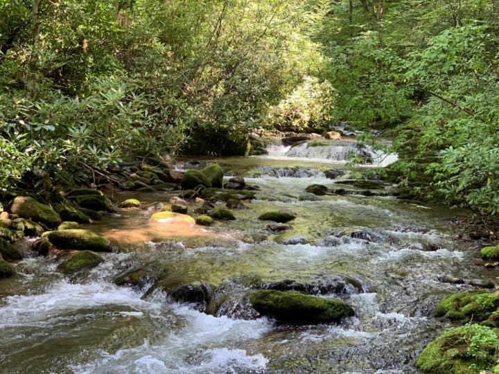
Deep Creek comes right up to the trail, even in low water.
When we reach campsite 53, I am amazed at the creek’s water level on this day, compared to when I hiked a similar route early in the year, which starts on the other side of the creek. It was so high then that I almost had to turn back around and retrace my 14 miles, until I discovered a log that I could scooch over to get past the more dangerous spots.
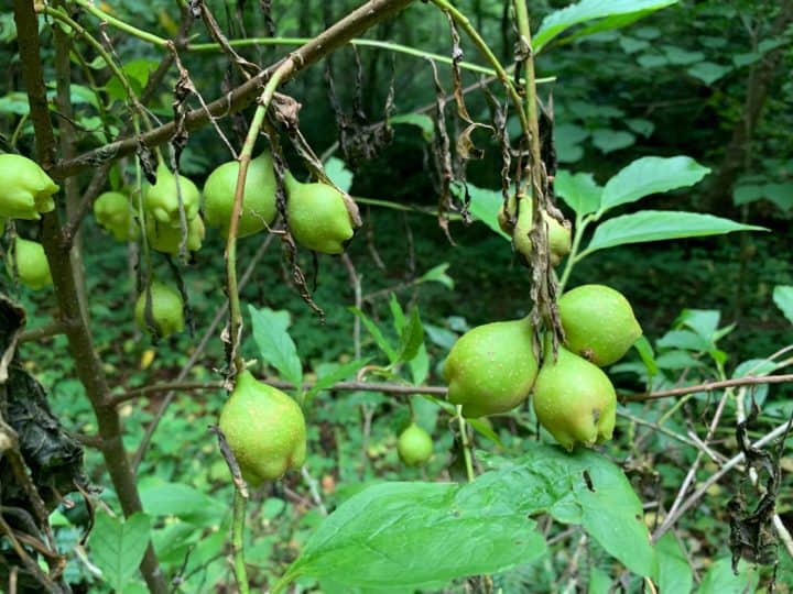
Buffalo Nut in campsite 53
We begin the vast majority of our 2,260 feet of elevation gain after passing by campsite 54, but it’s never so steep that it feels overly draining. Keen is wearing new shoes and begins to become bothered by a wonky hip, likely his body adjusting to the new shoes. He is such a strong hiker, so it’s odd to see him trailing behind, and I know it’s frustrating to him.
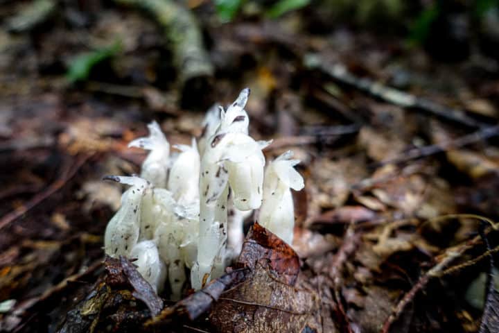
Indian Pipe
Along the way, I nearly step on and/or miss seeing three different snakes on or slightly to the side of the trail! Thankfully, they’re all harmless brown snakes, but it makes me laugh (a little nervously) thinking of how many snakes I’ve probably crossed paths with in all my years of hiking and not even realized they were there (except my encounter with 2 rattlers on one hike–glad I saw and heard them)!
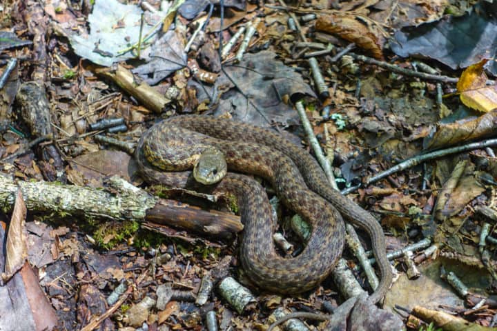
One of our little snake friends
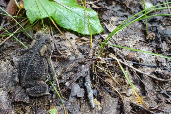
I missed this guy too, until Jerry, a.k.a. Eagle Eye, spotted him!
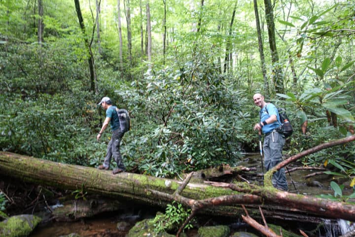
Finally, we reach the top, right where we left the cars several hours before. I’m happy to report that Jerry and I did in fact get along as well as I thought we would! I look forward to hiking with him again, and I always look forward to my next adventure with Keen. Hiking friends are the best!
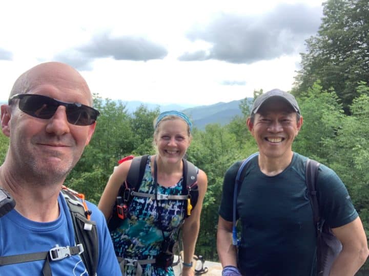
I love an adventure with friends as fun as these guys!
Jerry heads back to his home in South Carolina and Keen to his in Knoxville. Me? Well, I’m headed to my temporary home for the next three nights at Elkmont and Cade’s Cove Campgrounds. I’ll share a campsite for one night with my good friend Lane, who is leading an off-trail hike elsewhere in the Park.
The next two nights I’ll be camping solo as I mop up bits and pieces of trails in the Cade’s Cove area of the Park. This endeavor will give me a taste of “van dwelling” in a mini van, and I’d be lying if I said I wasn’t excited about the prospect of sleeping on an air mattress instead of an inflatable Neoair sleeping pad! Off I go!
(Thanks to Jerry for letting me use some of his photos for this post!)
TRAIL REPORT CARD and GPX TRACK
Mileage: 15.0 miles
Type of Hike: One way, shuttle hike.
Potential Hazards: Water crossings in the Smokies can be dangerous in high water. For your own edification, The “$1 map” of the Smokies has a very helpful list of all the streams in the Smokies that may be difficult and/or dangerous with high water during or after rain. It’s wise to consult this list before any hike, to see if you might be faced with turning around unexpectedly!
Suitability for Kids: I think some fit teenagers might enjoy this hike, because of the water crossings and the diversity of scenery in the higher and lower elevations.
Dog Friendly: No. Dogs aren’t allowed on trails in Great Smoky Mountains National Park with the exception of the Gatlinburg Trail and the Oconaluftee Visitor Trail.
Permits: No permits are needed to hike the trails in Great Smoky Mountains National Park, but they are required for camping in the backcountry. Reservation information for backcountry website the park’s website. And clearly, you shouldn’t park in the Cade’s Cove Picnic Area if you plan to backpack this route.
National Geographic Trails Illustrated Map of Great Smoky Mountains National Park

I carry the 10 essentials in my pack at all times and you should too! If you’d like to know what gear I use and recommend, here’s my gear list. I also invite you to join my Facebook Group, where I not only post the best deals on quality gear that I can find, but I also provide education on backcountry safety topics via Facebook Live events. It’s a fabulous group of people and I like to think of it as one of the nicest Facebook groups out there. 🙂
My Gaia Tracks from This Hike
If you are interested in using Gaia, you can get a 20-50% discount off a Gaia subscription (and I highly recommend it). I use it for both SAR and personal use exclusively.
[content-upgrade id=”3163″]