Overview of my Hike
The following is a trail report for both the Old Settler’s and Ramsey Cascades Trails in Great Smoky Mountains National Park. I completed both of them as a long day hike in late April, and I hiked them solo.
Old Settler’s Trail Journal
I start my day with a drive to the Greenbrier area of the Park at the Old Settler’s Trailhead and meet with Mark, the owner of AAA Shuttle Service. I took courses at Great Smoky Mountains Institute at Tremont with Mark’s wife, Pam, a few years ago. Pam and I paired up for a presentation on bizarre mating rituals of animals of the Smokies. It was quite possibly the most entertaining presentation I’ve ever given in my life, and you become quick friends when you team up for this sort of thing!
Mark meets me promptly at 7:30 a.m. and we make the drive to the opposite side of Old Settler’s Trail. He is easy to talk to on the drive over, and I highly recommend his services if you need a shuttle in the Park.
The Maddron Bald Trail intersects the Old Settler’s Trail 1.2 miles from the trailhead, so I start the gentle climb to its intersection. Five minutes into my walk, I see an animal in the distance, crossing the trail perpendicularly, clearly stalking some sort of prey on the opposite side of the trail with its crouched, slowly methodical movements.
From a distance, all I can make out easily is a long tail and it looks bigger than a fox at first glance. Surely it’s not a mountain lion, I think to myself. There have been sightings in east Tennessee, and for a moment I’m both equally excited and scared about the species I’m witnessing.
The “cat fox” in the distance!
The animal catches me in its peripheral vision and forgets its hunger, quickly moving further away from me up the trail. I grab my phone, hoping to take a photo that helps me decipher what it is, but it’s too far in the distance to get a good shot. I’m 99.9% sure it was a grey fox, but it sure made me pause for a moment and think!
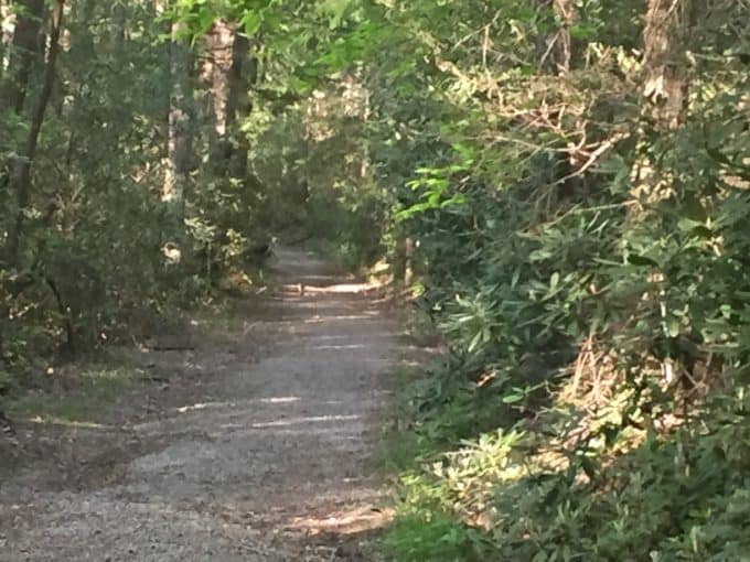
With it out of my sight I make my way forward, still unsure at this point what kind of animal it was, looking behind my shoulder several times to make sure I’m not the one being stalked now! At the trail intersection, I turn onto the Old Settler’s Trail and start my walk through history.
The beginning of the Old Settler’s Trail
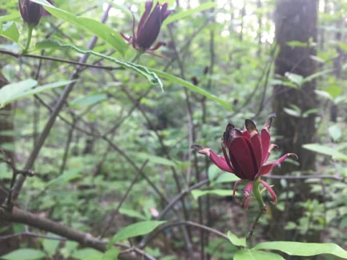
Spice Bush is one of my favorites to come across. There is nothing like the smell of the oils in their leaves .
As I pass by all the rock walls, chimneys, and other artifacts, I find myself wishing I had saved this particular hike to do with someone who knows more than I do about what I’m walking past. There are plenty of books and websites that relay the rich history of this trail and region, and I could have brought one with me. But my mileage goal today is ambitious (25 miles) so I left them behind and vow to read more about the trail when I return home.
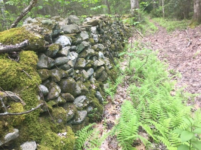
There were so many rock walls lining the trail.
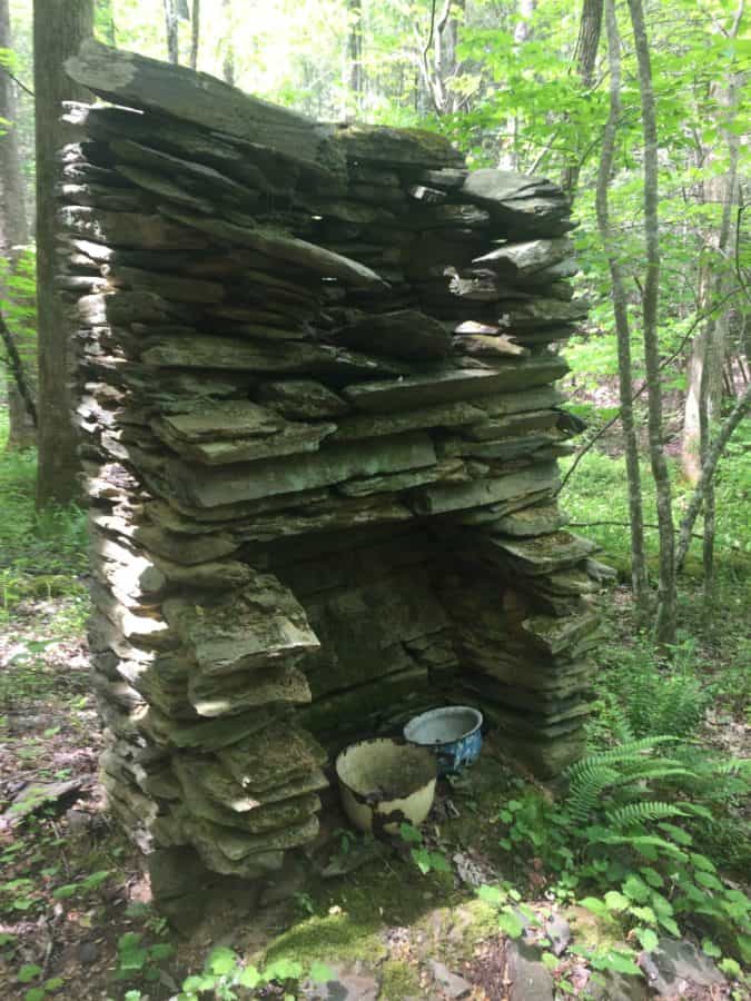
Lots of chimneys and artifacts along the trail.
The trail meanders along, rising and falling gently and it’s easy hiking….except for the bazillion (slight exaggeration but it’s how it felt after awhile) dead trees across the trail. The trail is also overgrown in many places, and I find myself cussing under (and over) my breath as I climb under, over, around, and through the various obstacles.
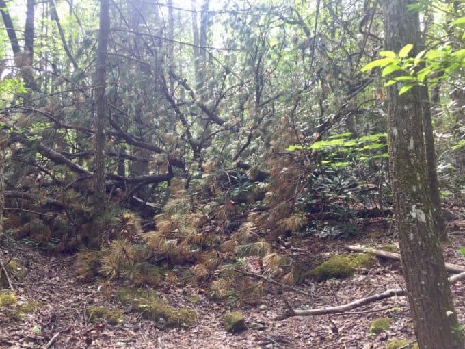
A typical tree scenario on the trail
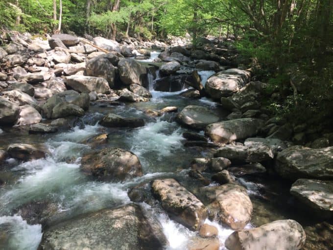
Most of the stream crossings along Old Settler’s are easy to rock hop across, at least when the water is low. There are a couple of moderately sized crossings though, and when I reach the first one, I decide it’s doable to rock hop across its large boulders.
The first two boulders are separated by just enough of a gap to make me slightly uneasy taking the leap. The alternative is wading through deeper water, and I’d really like to avoid taking my shoes off this soon (or getting them soaked this early in the day). If I stretch my legs from one to the other I can touch the other boulder, and it doesn’t feel as slick as the one I’m standing on. I think I can stick the landing.
I leap and my right foot hits the boulder as my left foot slips off the edge of the other, falling straight into the water. My right leg then follows suit, with my knee crashing down onto the boulder and into the water to join my left leg. I’m immediately thigh deep in a cold, swift current between the two boulders. Thankfully, nothing was hurt more than my pride and a bruised knee as I awkwardly climb out of the water. I chide myself for making a bad judgement call on a solo hike. Live and learn.
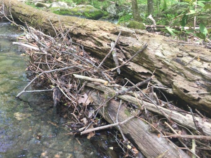
Beaver dam or just leftovers from a flash flood? I was actually able to walk across this log, for which I was thankful!
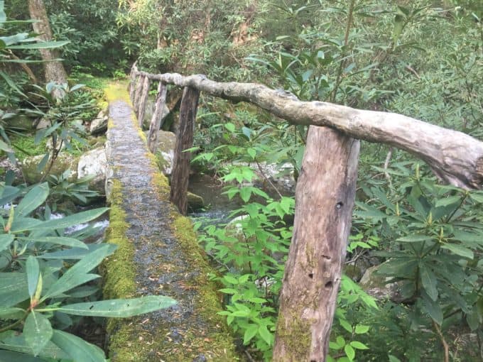
If only all the crossings had nice bridges like this one!
As I start hiking again, I remember a story I recently read about how the Park’s archivist, Michael Aday, did exactly what I was doing (on the same trail, no less) at a different stream crossing. He wasn’t so lucky when he suffered a compound fracture of the tibia in his fall and had to be rescued by the Park’s SAR team.
Safety Snippet: Rock hopping is one of the easiest and most common ways to potentially injure yourself on a hike. Many rocks are incredibly slippery, especially if they are wet in places. Do as I say and not as I did–don’t take unnecessary risks while crossing streams via rock hopping!
About half way through the trail, as I’m cresting a small rise and descending towards a stream below, one of the most magical things that has ever happened to me on a trail occurs. A Blue Heron hears me coming and rises from his spot on the creek. He appears to levitate off the water, so close to me I feel as if I can reach out and touch him. He starts to fly upstream, is quickly met with a dense rhododendron thicket at his level of flight, so he gracefully glides around into the other direction and flies away. It literally takes my breath away and I say out loud, “That was one of the most beautiful things I’ve ever seen in my life.”
All my frustration about the conditions of the trail and my stupid choice during the creek crossing melt away when I’m left with this memory. I still navigate through plenty of obstacles but my feet feel lighter now, and I tackle them with a better attitude.
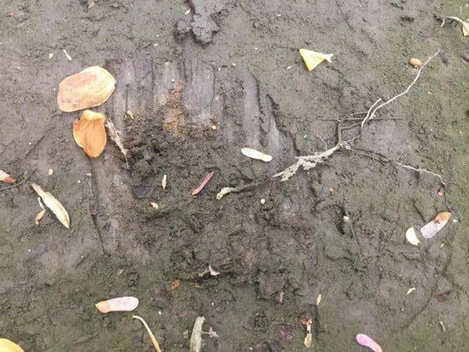
Bear track? I wasn’t quite convinced but I couldn’t think of what else it could be.
After a quick snack break at campsite 33, I carry on. I eventually pass two women (the only people I encountered on this trail) about a mile from the end, and they ask me if I am hiking its entire length. When I tell them I am, one of them says, “We heard it’s pretty brutal right now.” Why yes, it is, but not if you make the acquaintance of a magical Blue Heron along the way.
Ramsay Cascades Trail Journal
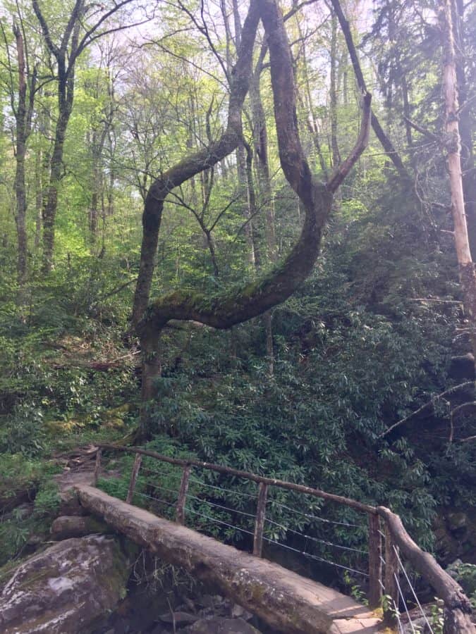
After finishing Old Settler’s Trail, I climb in my car and make the short drive to the Ramsey Cascades trailhead. I’ve been reluctant to hike this trail, because I know I’ll lose the solitude I crave in the backcountry. It’s a popular hike and for good reason–its scenery is stunningly beautiful.
Despite having just hiked 16 miles, my legs feel surprisingly fresh after the short driving break. The only thing that potentially slows my progress is the temptation to stop at several sweet swimming holes to dunk my sweaty body and get some of the grime off. I choose to keep heading upwards, promising myself I’ll do it as I’m coming back down and need to filter more water.
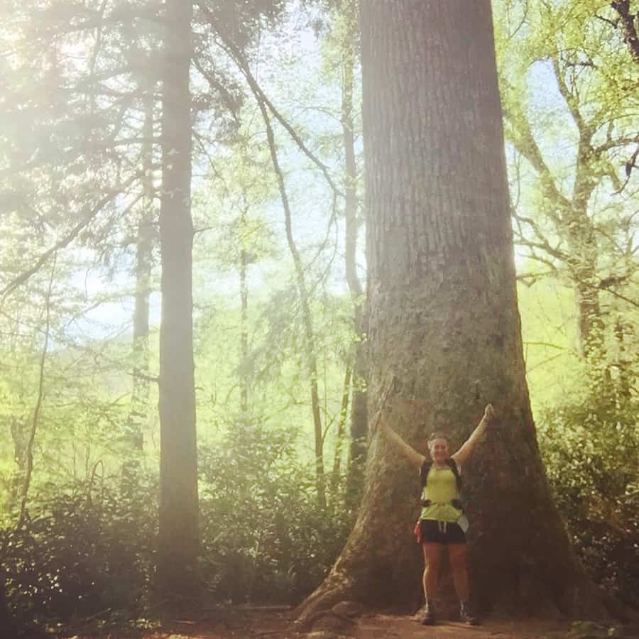
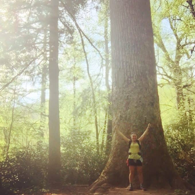
I’m in awe at the size of two Tulip Poplar trees on either side of the trail, about half way up the trail, standing tall like sentries. There is a third one, even larger than the other two, that I encounter shortly thereafter. I can’t resist taking a photo in front of it, to give it some scale. I look so tiny in comparison!
Nature Nugget: Did you know Tulip Poplar trees actually aren’t Poplar trees at all? They’re in the Magnolia family, so a more accurate, but less commonly used, name for them is Tulip Magnolia.
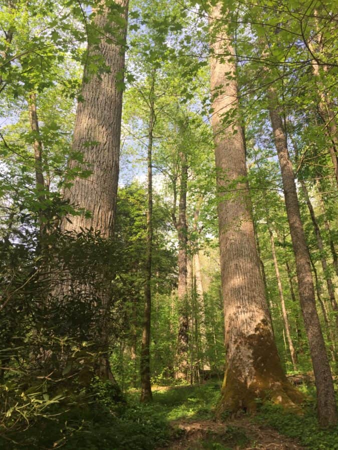
Guardians of the trail
The trail is in surprisingly good shape for the amount of foot traffic it receives each day, but I’m still irked by carvings in trees and toilet paper “flowers” strewn on the side of the trail.
Leave No Trace Tip: Pack it in, pack it out, and that includes toilet paper. Every single time. No exceptions. Better yet, use the best “pee cloth” on the planet, the Kula Cloth, which eliminates the need for TP if you just need to pee!
When I reach the falls, there is a large group of men and women sitting on an enormous boulder beside the trail. They are laughing and singing and wearing some sort of long, brown robes (perhaps Buddhists)? They are all very pleasant and friendly and give off a peaceful vibe. I feel so intense and hurried in comparison.
Safety Snippet: Just like rock hopping can be deceptively dangerous, so can climbing waterfalls. It is one of the most frequent ways people die in the backcountry (including this particular waterfall) and I can’t stress enough how important it is to stay safe around them.
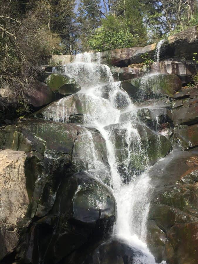
Ramsey Cascades did not disappoint!
I take a few pictures and then head back downhill, eager to get to one of the swimming holes where I can dip myself in the water for a refresher. I find one, take off my pack and decide to filter water first since I’m thirsty and drank the last drop at the waterfall. By the time I filter water I’m not as hot anymore, and soaking my bare feet in the stream is enough to satisfy the urge for a swim.
Safety Snippet: I highly recommend you filter every drop of water you drink from a stream in the Smokies (or any body of water in the backcountry). While the water may look crystal clear and clean, contracting Giardia and Cryptosporidium are very real risks these days and will make your life less than pleasant.
I head down the trail, still feeling amazingly good for a high mileage day. Must be the good scenery around me, taking my mind off the miles. In the last stretch, my feet finally start to protest a little, and I’m thankful I’m close to the trailhead.
I reach my car and make the dusty drive out of Greenbrier, thrilled to have spent another long day in my happy place!
TRAIL REPORT CARD and GPX TRACK
Mileage: 25.4 miles total, which includes both Old Settler’s and Ramsey Cascade Trails
Ascent: 5073 ft. Descent: 5271 ft.
Type of Hike: One way (Old Settler’s Trail) and out and back (Ramsey Cascades)
Potential Hazards: There are many fallen trees across Old Settler’s Trail as of April 2019. None of them are terribly dangerous to navigate around, but they will slow your pace. Stream crossings were all manageable at the time of my hike, but after heavy rains I think a few could be dangerous. And as stated above, be careful rock hopping across any stream!
Suitability for Kids: Ramsey Cascades would make a great family outing, assuming children are able to cover the distance (8 miles round trip) and handle the elevation gain and loss. Old Settler’s would certainly hold interest for children, given the number of old homesteads and artifacts; however, it might be a bit long for most kids, at least to keep them interested.
Dog Friendly: No. Dog’s aren’t allowed on trails in Great Smoky Mtns. National Park with the exception of the Gatlinburg and Oconaluftee River Walk Trail.
Permits: No permits are needed to hike the trails in Great Smoky Mountains National Park, but they are required for camping in the backcountry. Reservation information for backcountry website the park’s website.
Of note, AAA Hiker Shuttle Service is a great service to use and create a one-way hike in the Park, if you don’t want to shuttle cars (or if you’re solo, like I was). It would be much more affordable with more than one person, since there is a flat fee up to a certain amount of riders.
National Geographic Trails Illustrated Map of Great Smoky Mountains National Park

I carry the 10 essentials in my pack at all times and you should too! If you’d like to know what gear I use and recommend, here’s my gear list. I also invite you to join my Facebook Group, where I provide education on backcountry safety topics via Facebook Live events, as well as share some great deals I find in the outdoor industry on quality gear. It’s a fabulous group of people and I like to think of it as one of the nicest Facebook groups out there. 🙂
My Gaia Track
If you are interested in using Gaia, you can get a 20-50% discount off a Gaia subscription through this link (and I highly recommend it–I use it for both SAR and personal use).
[content-upgrade id=”3163″]