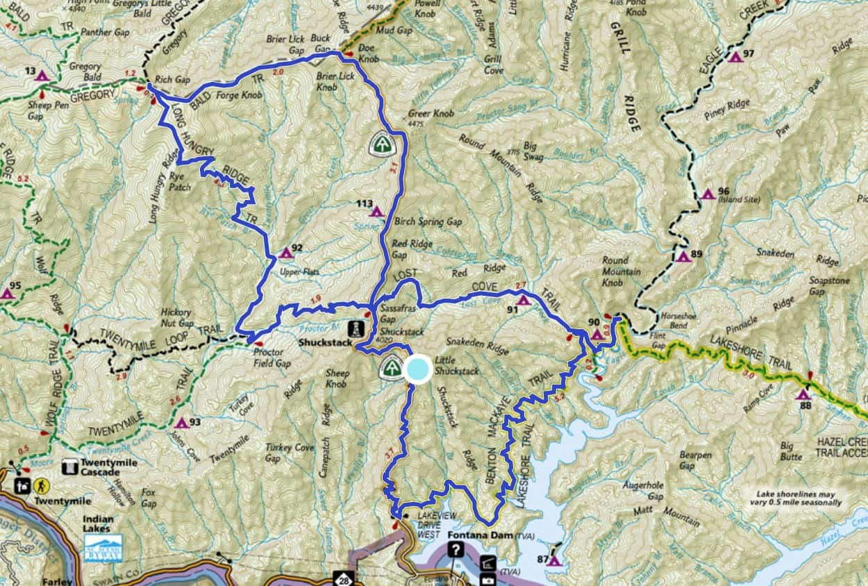
The following is a trail journal of a 25-mile “figure 8” loop hike in Great Smoky Mountains National Park, connecting the following trails: Appalachian Trail, Gregory Bald, Long Hungry Ridge, Twentymile, Lost Cove and Lakeshore Trails. A side trip to the Shuckstack Fire Tower is highly recommended if you have the time. This hike was taken in late February with my training partner and good friend, Chris.
Trail Journal
As Chris and I continue to train for our “really big thing we’re doing this spring” (I promise, the secret will be out soon!), we keep tackling moderate-to-us-distance day hikes. My plan is to do them enough that they make a 25-mile hike feel like a short and easy day. So far, it’s paying off. The hardest part, however, is when we reach the end of these hikes. I realize we’ll still have many miles to go before we sleep when our big challenge starts!
We meet at 7:30 a.m. at Fontana Dam and begin our journey on the A.T., heading north. We encounter a prospective thru hiker in the first mile. He seems to be doing well and holding his own. We stop for a few minutes to chat, but we know how tough miles are to earn in the Smokies, so we don’t keep him idle too long (plus, we have to earn our own ambitious miles before dark).
The A.T. climbs fairly steeply, levels out, then starts climbing again. It’s a repeated process and our conversation distracts me from my huffing and puffing. I’ve gotten really good at asking Chris questions on the uphill climbs, to keep him from completely losing me with his long stride and legs!
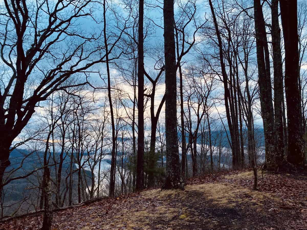
Morning light across the lake from the A.T.
We reach the turnoff for the Shuckstack tower and decide to forego the nearly half mile round-trip effort it takes to reach it. Chris is indifferent, we’ve both visited it on past hikes, and our upcoming water crossings on Lost Cove are making me a tad anxious. I want plenty of daylight left when we reach them, so we make can a wise decision as we face them.
We reach the junction with Lost Cove Trail soon after. But for now, we continue to head north on the A.T. The pitches of the climbs continue to get steeper, but we power through them and make quick time to the next intersection with Gregory Bald Trail.
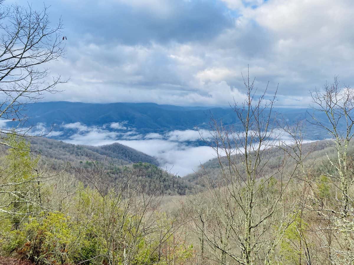
Moody skies while we climb
We hang a left on Gregory Bald Trail. I tell Chris the story of one of my hikes last winter when I had the great fortune of meeting three brothers out on a backpacking trip. I still keep in touch with them, and it makes me smile, thinking of how small our hiking community is in the Smokies.
The climbs to the junction of Long Hungry Ridge Trail aren’t long, but darn they’re steep! We both verbally complain about them and my fatigued legs feel validated, hearing Chris say something out loud about it (he’s a beast and sometimes I’m convinced he doesn’t feel pain or fatigue).
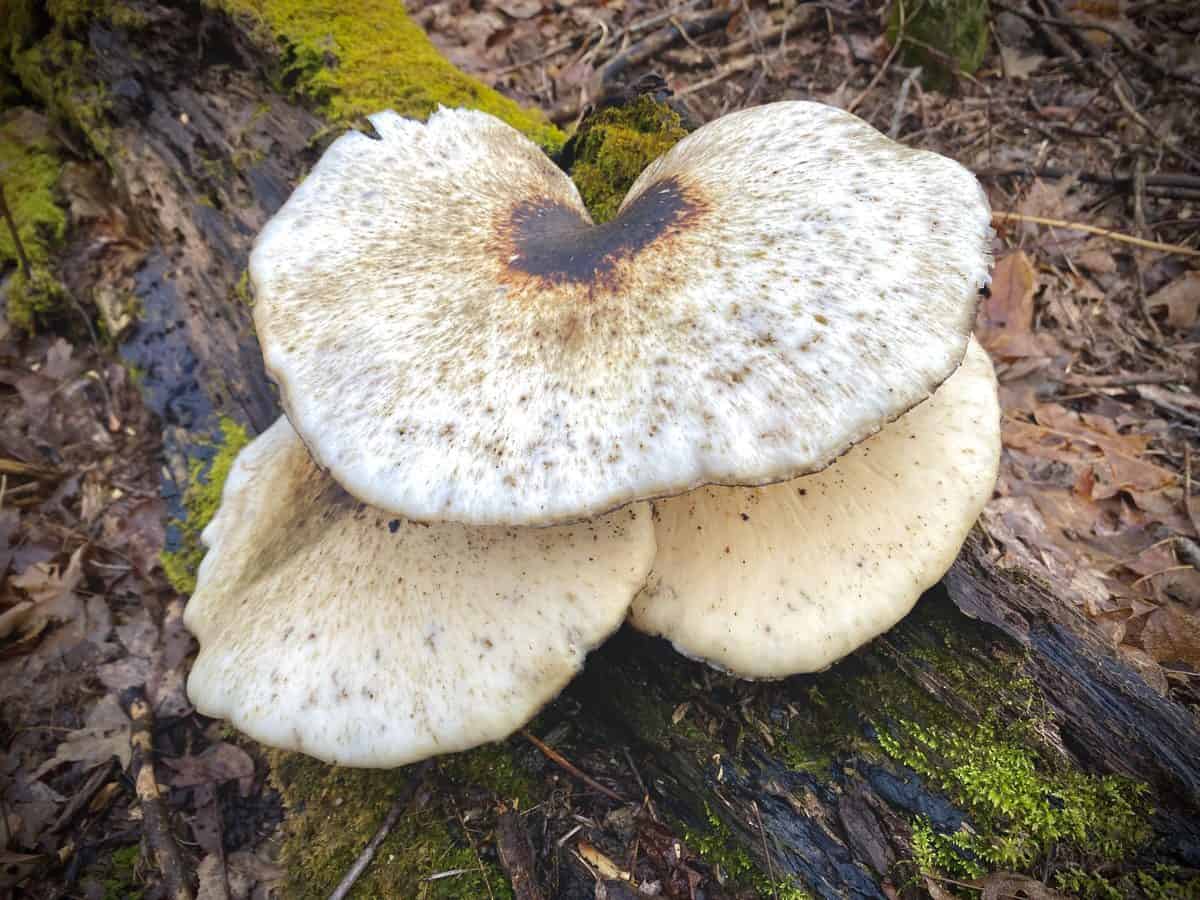
Cool shelf fungus (and a good excuse to stop climbing for a minute and snap a photo)!
We make a quick 0.1 mile out and back to the intersection of Gregory Ridge Trail. On the opposite side of the junction, there is a sign instructing horse riders to not go beyond this point and there’s a faint trail behind it. Chris believes it’s the home of a former shelter on the A.T. (this stretch of trail was once the A.T., before Fontana Dam was built). If you’re reading this post and know for sure, we’d love to know–we didn’t take the time to explore, and of course, now I wish we had!
Long Hungry Ridge is cruiser trail and we make great time descending it. At the junction of Long Hungry Ridge and Twentymile Trails, we take our first break and eat our lunches. I have a leftover burrito from Moe’s (a free one since I had a birthday reward on my app!) and it’s a bit soggy. It’s carb and fat laden calories hit the spot though, and we’re ready to crank out our last big climb of the day on the nearly 2-mile uphill slog to the A.T.
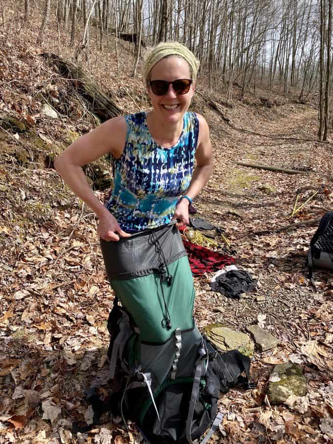
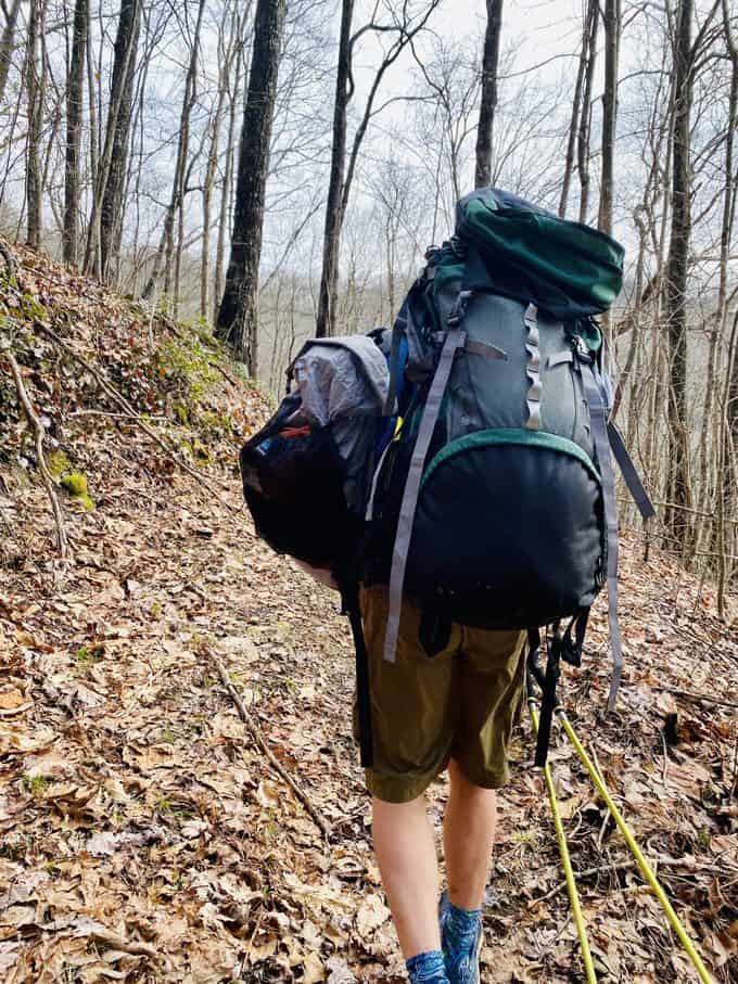
Two miles can feel like twenty in a post-prandial state of mind, so it passes by slooowly, despite the decent pace we keep. I’m starting to think whoever named this trail had the same thought! About a quarter mile from the top of the trail, we see a large backpack hanging on a tree. “I know about this pack!” I exclaim. I had seen posts about in a couple of Facebook Groups over the last couple of weeks. It has clearly been abandoned, and its rightful owner must not be too concerned that its contents are gradually becoming destroyed by the elements.
We decide to take it down and do a shakedown on it. Its contents reveal the gear of either a very new backpacker or someone who doesn’t mind carrying a very heavy pack. The empty pack is enormous and literally weighs as much as my fully loaded day pack. Chris makes a comment that I could probably fit inside it. Since I’ll do anything to delay the rest of our climbing, I take on the challenge! It’s too difficult to shimmy down into it past my (large) hips, but Chris tells me I look like a mermaid so I get him to snap a photo!
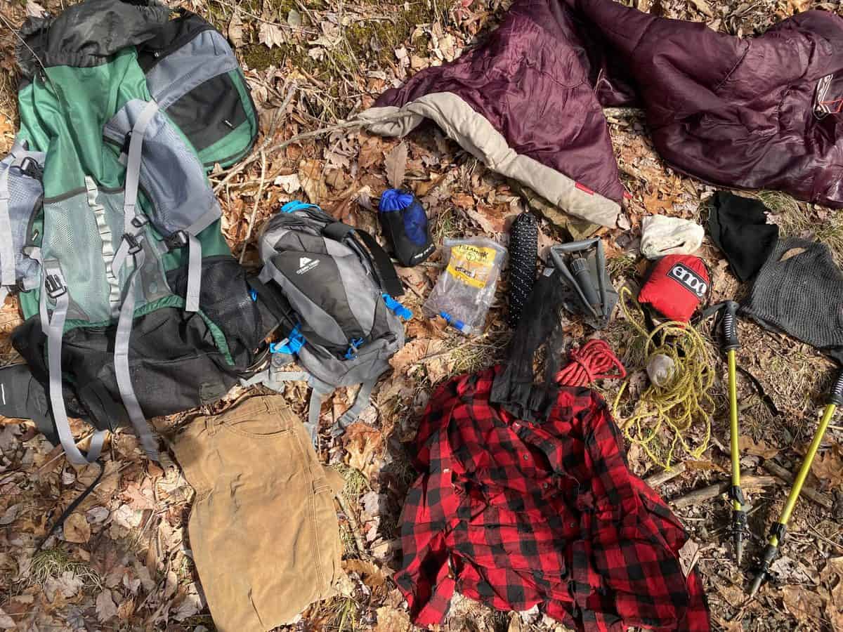
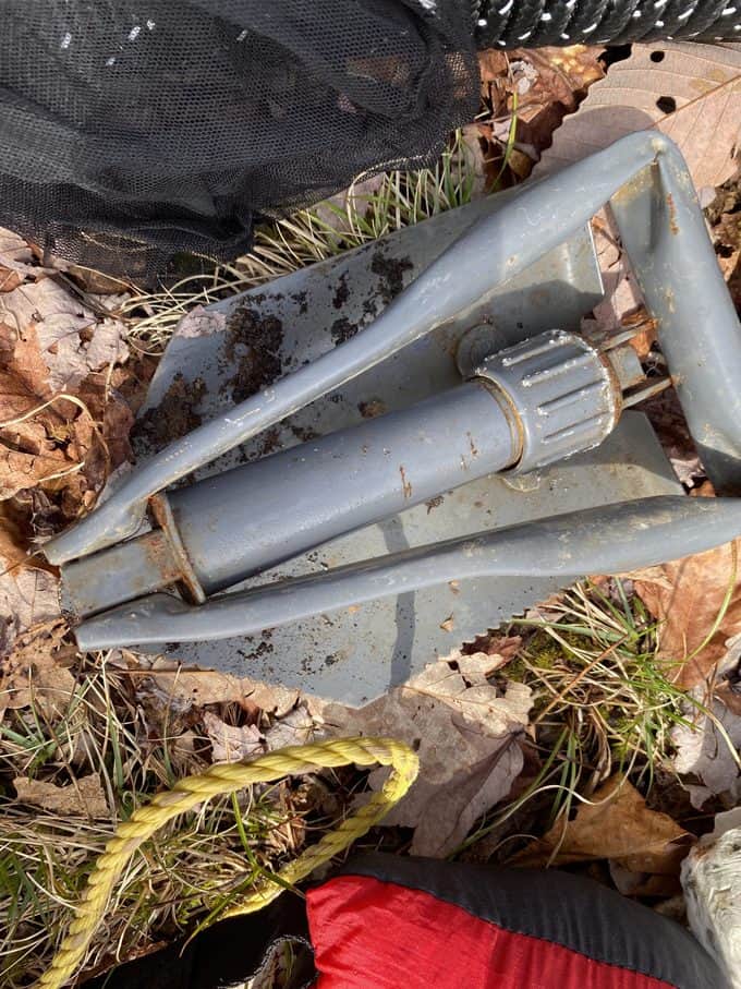
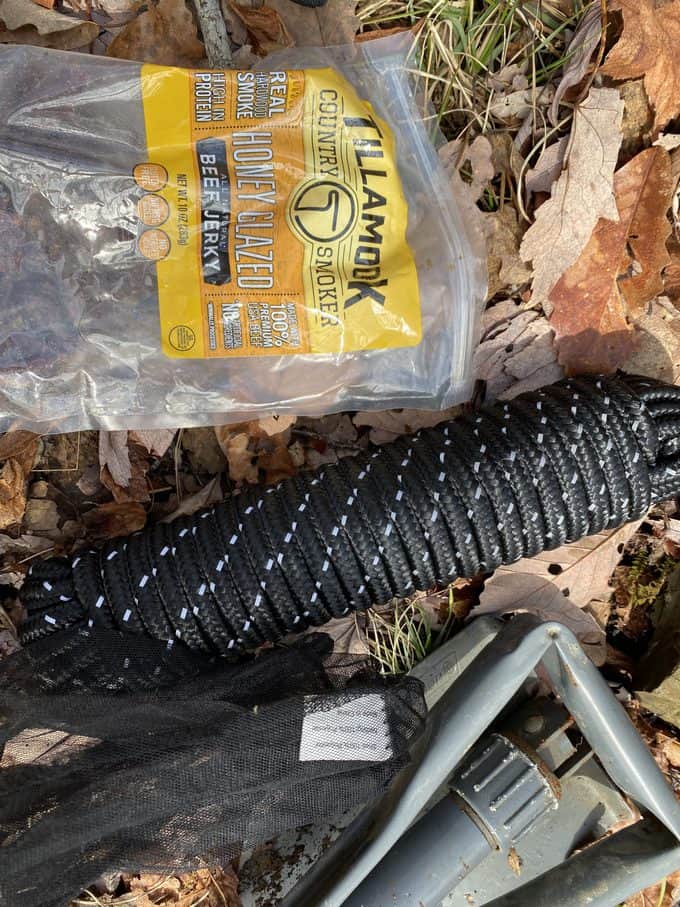
We still have about 10 miles of hiking left, so it’s not an easy task to take the pack out with us; however, Chris does carry it up to the A.T. and we leave it propped beside a tree. Maybe the ridge runners will eventually figure out and get it down the 3.7 miles to the trailhead at Fontana. I decide it’s worth taking the jerky with us; not because I want to eat it, but because I don’t want the bears to sniff it out and associate backpacks (and hikers) with food.
Chris gets MVP of the hike for carrying the heavy ass pack to the A.T. where it might stand a chance of being removed (or its contents scavenged by A.T. thru hikers in need of something like the hiking poles in it)
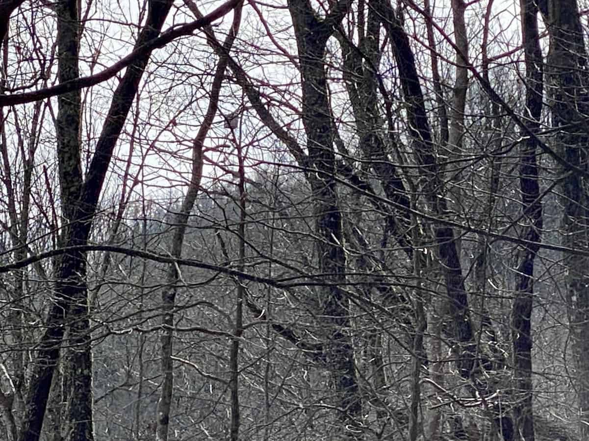
Can you find Shuckstack fire tower on the top of the mountain in the distance?
We’re back at the midpoint of our “figure 8” route, and this time we descend onto Lost Cove Trail. I have hiked this trail both ways and I definitely prefer going down it. It’s so freaking steep! The first time I hiked it, I was in Chaco sandals; I had met an A.T. thru hiker the week before who only wore Chaco’s hiking, so I thought I’d give it a shot. A collection of blisters after the endeavor quickly convinced me that it wasn’t for me. I’m thankful for the lugs in my Altra Lone Peaks, as I don’t fall a single time as compared to the 2-3 times I slipped and fell in those darn sandals!

Chris discovered this little cutie. His other eye appeared to be missing from a prior injury.
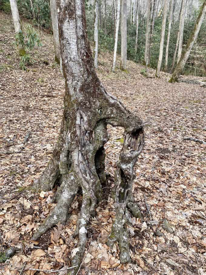
I love this tree on Lost Cove Trail.
The water crossings on Lost Cove are very manageable, surprisingly, so we make good time getting through them and down to the lake and campsite 90. I laugh as I remember the story of my craziest backpacking trip ever when I stayed at this site. Among many over-the-top experiences, we had a bear in our camp and I was bluff charged by a different bear the next day while hiking! We make a quick 1.8 out-and-back jaunt to the junction of Eagle Creek Trail, since we’re both marking our next maps, then head out the 5.2 miles on Lakeshore Trail.
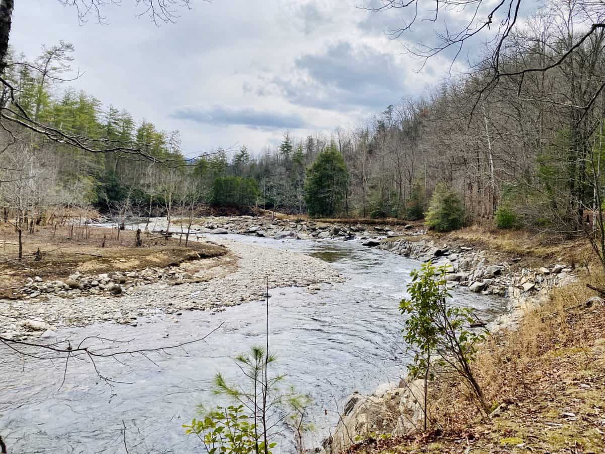
I love this stretch of trail just before the campsite, especially in winter. It reminds me of the riverbanks out west.
On one of the Lost Cove water crossings, I torqued my knee a funny way as I was trying to dislodge my foot from two boulders I got it stuck between. It’s causing a fair amount of pain each time I step during our last 5 miles, and it worries me. I don’t say anything to Chris about it until close to the end of our hike. But by then, it’s lessened a good bit and only hurts when I bend it a certain way. Whew, I do not need a nagging injury right now!
We reach our cars and begin our predictable routine of peeling off wet shoes and socks, putting on sandals, and pulling out our post-hike drinks (Chris, a protein drink called Bertrand, and me, kombucha). We nervously laugh at how many daily miles we’ll have left to hike this spring, when we both start our new maps of the Smokies. Chris jokes and says, “Well, we could always go back up and bring the backpack down tonight–that would get us closer!” If my knee hadn’t been so tweaky, it’s the kind of crazy shenanigan I could easily be talked into. But I want to play it smart and end the day on a good note.
We bid each other farewell and I say goodbye to the fading light of day on my way home.
Happy Trails,
Nancy “Seal Mom”
TRAIL REPORT CARD
Mileage: 24.85 miles
Potential Hazards: Winter weather is a wild card in the Smokies, and you should always check the weather forecast before leaving on a hike (and several days after your hike, just in case you’re out longer than expected). Always leave for a hike expecting to stay out overnight, just in case you’re forced to with an injury, are lost, etc (SAR teams will never arrive as quickly as you’d like them to).
Lost Cove has several unbridged creek crossings that can become treacherous in high water. There is also a tricky crossing on Long Hungry Ridge Trail if the water is high.
Suitability for Kids: This is a longer route than most kids would enjoy; however, a shorter 12-ish mile loop can be made by combining the A.T. (with a side trip to Shuckstack’s tower), Lost Cove and the Lakeshore Trail
Overnight Option: There are plenty of choices along this route that make it a fun overnight trip. Campsite 91 on Lost Cove Trail makes a nice mid-way spot to stop, but campsite 90 is also nice (and large). Campsite 90 has frequent bear issues in the summer though (as well as frequent rattlesnake sightings along the lakeshore), just FYI.
Dog Friendly: No. Dogs aren’t allowed on trails in Great Smoky Mountains National Park with the exception of the Gatlinburg Trail and the Oconaluftee Visitor Trail.
Permits: No permits are needed to hike the trails in Great Smoky Mountains National Park, but they are required for camping in the backcountry. Reservation information for backcountry website the park’s website.
Navigation Resources
National Geographic Trails Illustrated Map of Great Smoky Mountains National Park

I use the GAIA app for all my hikes. If you are interested in using GAIA, you can get a 20-50% discount off a subscription (and I highly recommend it). I use it for both SAR and personal use exclusively.
You can find my trail journals for other hikes in the Smokies right here.
RECOMMENDED GEAR
I carry the 10 essentials in my pack at all times and you should too! If you’d like to know what gear I use and recommend, here’s my gear list.
P.S. If you’re interested, and especially if you’re new to hiking or backpacking, I invite you to join my Facebook Group, where I post the best deals on quality hiking/backpacking/camping gear that I can find. But more importantly, I provide education on outdoor safety topics, based on my SAR operations. It’s a fabulous group of people and I like to think of it as one of the nicest Facebook groups out there. 🙂
[content-upgrade id=”3163″]